Our accompanying video is now available on YouTube.
FAST-LIVO: Fast and Tightly-coupled Sparse-Direct LiDAR-Inertial-Visual Odometry
FAST-LIVO2: Fast, Direct LiDAR-Inertial-Visual Odometry
Our paper is currently undergoing peer review. The code, dataset, and application will be released once the paper is accepted.
This section showcases representative results of FAST-LIVO2 with high-resolution screenshots, allowing for easier observation of details.
All sequences in FAST-LIVO2 private dataset are captured using low-cost Livox Avia LiDAR + pinhole camera.


Left: "Banner Wall" sequence (severe LiDAR degeneration), Right: "CBD Building 02" sequence (severe LiDAR degeneration)

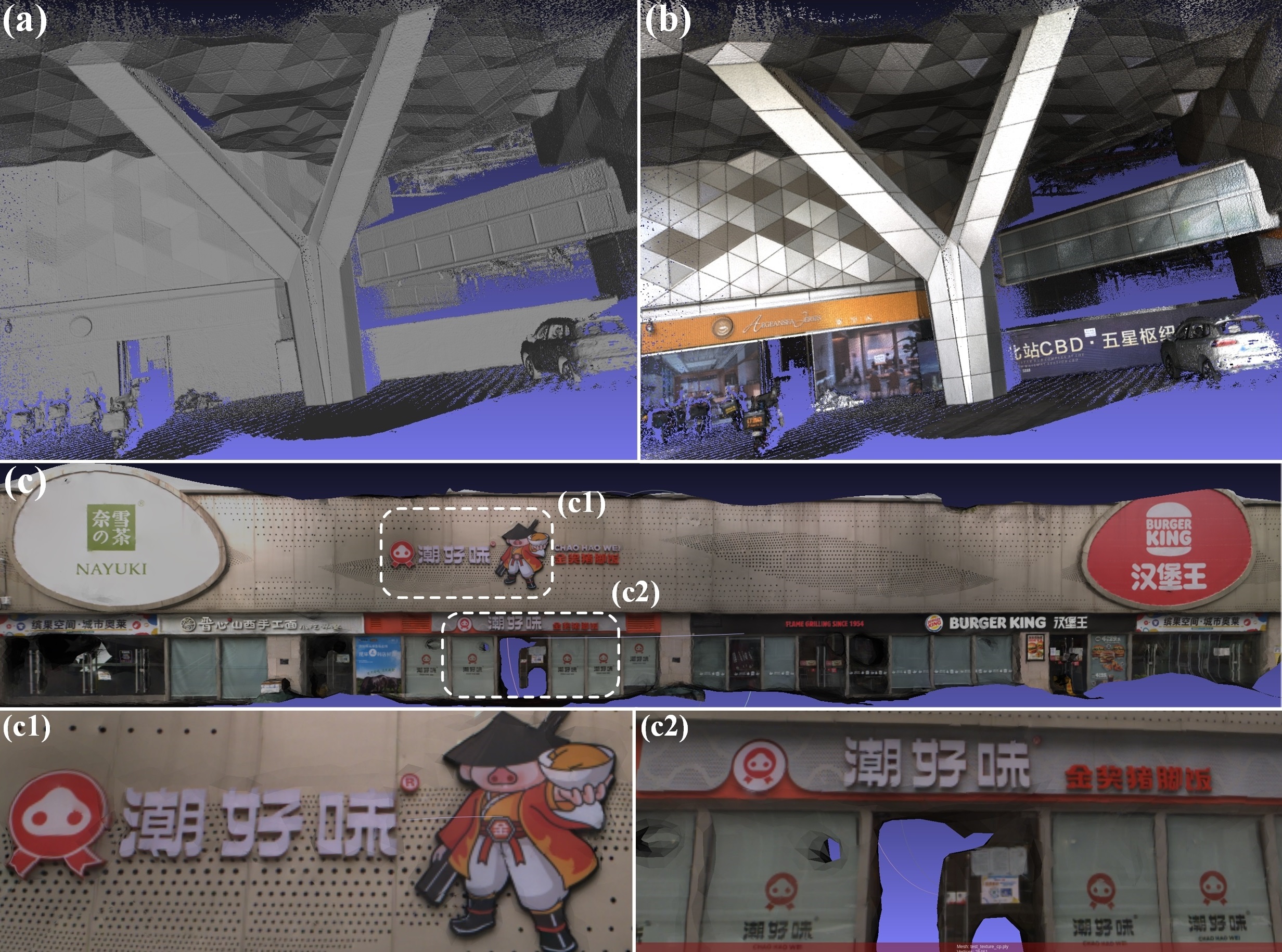
(a) and (b) are the mesh and texture mapping of “CBD Building 01”, respectively. (c) is the texture mapping of “Retail Street”, with (c1) and (c2) showing local details.

Comparison of ground-truth image, COLMAP+3DGS, and FAST-LIVO2+3DGS in terms of render details, computational time (time for generating point clouds and estimating poses + training time), and PSNR for a random frame in “CBD Building 01”.
We mark a pioneering instance of employing a LiDAR-inertial-visual system for real-world autonomous UAV flights. Our UAV, equipped with LiDAR, a camera, and an inertial sensor, performs online state estimation (i.e., FAST-LIVO2), trajectory planning, and tracking control, all managed entirely by its onboard computer.

(a) shows the overall point map of the "Basement" experiment. In (a1)-(a4), white points indicate the LiDAR scan at that moment, and colored lines depict the planned trajectory. (a1) and (a4) mark areas of LiDAR degeneration. (a2) and (a3) show obstacle avoidance. (a5) and (a6) depict the camera first-person view from indoor to outdoor, highlighting large illumination variation from sudden overexposure to normal.

(a) and (b) show the enlarged point maps of the "Woods" and "Narrow Opening" experiments, respectively. The red points in (a1), (a3), and (b4) represent the LiDAR scan at that moment. (a2) and (a4) represent the first-person view at the corresponding locations. (b1)-(b3) depict the third-person view.


