텐마일 강(웨스트 포크 강 지류)
Tenmile Creek (West Fork River tributary)| 텐마일 강 | |
|---|---|
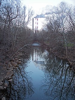
 2006년 Lumberport의 Tenmile Creek | |
| 위치 | |
| 나라 | 미국 |
| 주 | 웨스트버지니아 |
| 자치주 | 해리슨 군 |
| 물리적 특성 | |
| 원천 | |
| • 장소 | 해리슨 군 남서부 |
| • 좌표 | 39°12/17°N 80°31′36″w/39.20472°N 80.52667°W[1] |
| • 고도 | 1,289 피트(393 m)[2] |
| 입 | 웨스트포크 강 |
• 장소 | 러버포트 |
• 좌표 | 39°22°39°N 80°20′21″w/39.3750°N 80.33917°W좌표: 39°22°39°N 80°20°21°W / 39.3750°N 80.33917°W / [1] |
• 고도 | 892 피트 (272 [1]m) |
| 길이 | 26.4 mi (42.5 km) |
| 유역 크기 | 126평방미(330km2) |
Tenmile Creek는 미국 웨스트버지니아 주 북중부에 위치한 [3]길이 26.4마일(42.5km)의 웨스트포크 강의 지류이다.웨스트포크, 모논가헬라, 오하이오강을 거쳐 미시시피강 유역의 일부이며, 알레게니 고원의 유리되지 않은 부분의 126평방마일(330km2)[4] 지역을 배수한다.
위치 및 지류
Tenmile Creek와 그 분수령은 전적으로 해리슨 카운티 서부와 북부에 위치해 있다.이 강은 웨스트 밀포드에서 서쪽으로 약 8마일(13km) 떨어진 카운티 남서부에서 발원하여 북쪽과 북동쪽으로 Lumberport 마을로 흘러 [5]남서쪽에서 웨스트 포크 강으로 합류합니다.그 지류에는 세일럼 시를 흐르는 세일럼 포크,[6] 그리고 해리슨 카운티 북서쪽과 월러스, 브라운, 도라,[5] 로즈버드의 작은 커뮤니티를 통해 남동쪽으로 흐르는 길이 [3]13마일(21km)의 리틀텐마일 [7]크릭이 포함됩니다.
분수령
웨스트 버지니아 환경보호부에 따르면, 텐마일 강 유역의 약 81%가 숲으로 이루어져 있으며, 대부분 낙엽성입니다.약 13%가 목초지와 농업에 사용되고 1% 미만이 [4]도시적이다.
대체명
Geographic Names Information System에 따르면 Tenmile Creek는 역사적으로 콜뱅크 [1]Creek로도 알려져 있다.
「 」를 참조해 주세요.
레퍼런스
- ^ a b c d Geographic Names Information System. "Geographic Names Information System entry for Tenmile Creek (Feature ID #1547966)". Retrieved 2007-02-19.
- ^ GNIS 소스 좌표에 대한 Google 어스 표고입니다.2007-02-12에 취득.
- ^ a b United States Environmental Protection Agency. "Watershed Assessment, Tracking & Environmental Results: Assessment Summary for Reporting Year 2008, West Virginia, West Fork Watershed". Archived from the original on 2011-10-14. Retrieved 2011-10-13.
- ^ a b West Virginia Department of Environmental Protection. "Watershed Atlas Project". pp. West Fork River watershed (cited figures are for Tenmile Creek and Salem Fork). Archived from the original on 2005-04-04. Retrieved 2007-02-26.
- ^ a b DeLorme(1997).웨스트버지니아 아틀라스 & 가제터메인 주 야머스:드로르메ISBN 0-89933-246-3.
- ^ Geographic Names Information System. "Geographic Names Information System entry for Salem Fork (Feature ID #1546293)". Retrieved 2007-02-19.
- ^ Geographic Names Information System. "Geographic Names Information System entry for Little Tenmile Creek (Feature ID #1542237)". Retrieved 2007-02-19.


