미국 오레곤 주 하원 선거구
| 오리건주 제2의회 선거구 |
|---|
 오리건주 제2 의회 선거구 - 2023년 1월 3일부터. |
| 대표. | |
|---|
| 지역 | 69,491 sq mi (179,980 km2) |
|---|
| 인구(2022) | 700,774 |
|---|
중위가구
소득. | $62,171[1] |
|---|
| 민족성 | |
|---|
| 직종. | |
|---|
| 요리 PVI | R+15[2] |
|---|
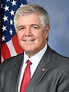
오리건주 제2의회 선거구는 오리건주의 6개 선거구 중 가장 크고, 전국에서 7번째로 큰 선거구입니다. 주 전체를 포괄하지 않는 전국에서 두 번째로 큰 의회 선거구이며, 2021년부터 온타리오주의 공화당 의원 클리프 벤츠가 대표를 맡고 있습니다.
이 지역은 윌라메트 계곡 동쪽에 있는 주의 약 3분의 2를 차지합니다. It includes all of Baker, Crook, Gilliam, Grant, Harney, Hood River, Jackson, Josephine, Klamath, Lake, Malheur, Morrow, Sherman, Umatilla, Union, Wallowa, Wasco, Wheeler counties, all but a small sliver of Jefferson County and the southeastern portions of Deschutes (excluding Bend and areas to its northwest) and Douglas Counties.
쿡 당파 투표 지수가 R+15로 오리건주에서 유일하게 확실한 공화당 지역구입니다.[2] 1981년부터 공화당의 손에 들어갔습니다.[3]
최근 주 전체 선거 결과
지역구를 대표하는 의원 명단
선거결과
출처(공식 결과만 해당):
1996
1998
2000
2002
2004
2006
2008
2010
2012
2014
2016
2018
2020
2022
주요 커뮤니티
지리적으로 넓은 지역으로 인해 2구에는 사회적, 경제적으로 서로 완전히 독립적으로 운영되는 다양한 커뮤니티가 포함되어 있습니다. 아래는 미국 인구조사국이 추적하는 제2구에서 가장 큰 통계 지역의 목록입니다.[9]
역사지구 경계

2003 - 2013

2013 - 2023
2000년 미국 인구조사 이전에는 조세핀 카운티의 대부분이 이 지역의 일부였습니다. 2010년 미국 인구조사 이후 지구 경계가 약간 변경되어 그랜트 패스의 일부를 2구에서 4구로 옮겼습니다.[10][11]
참고 항목
참고문헌
- 특정한
- ^ "My Congressional District: Congressional District 2 (118th Congress), Oregon". United States Census Bureau.
- ^ a b "2022 Cook PVI: District Map and List". Cook Political Report. Retrieved January 10, 2023.
- ^ DeBonis, Mike (October 29, 2019). "Rep. Greg Walden, top Republican on powerful House panel, says he will retire". Washington Post. Washington, DC. Retrieved October 28, 2019.
- ^ "November 6, 2012, General Election Abstract of Votes". Oregon Elections Division. Retrieved December 5, 2012.
- ^ "November 4, 2014, General Election Abstract of Votes". Oregon Elections Division. Retrieved February 6, 2016.
- ^ "2016 General Election Results". Oregon Elections Division. Retrieved August 30, 2017.
- ^ "2018 General Election Results". Oregon Elections Division. Retrieved December 19, 2018.
- ^ "2018 General Election Results" (PDF). Oregon Elections Division. Retrieved December 19, 2018.
- ^ "Metropolitan and Micropolitan Statistical Areas Population Totals and Components of Change: 2020-2021". U.S. Census Bureau. Retrieved July 5, 2022.
- ^ Mapes, Jeff (June 29, 2011). "Oregon legislators reach agreement on congressional redistricting". The Oregonian. Retrieved July 27, 2011.
- ^ "Oregon's Congressional Districts (Senate Bill 990)" (PDF). Oregon Legislative Assembly. Retrieved July 27, 2011.
- 일반
- Martis, Kenneth C. (1989). The Historical Atlas of Political Parties in the United States Congress. New York: Macmillan Publishing Company.
- Martis, Kenneth C. (1982). The Historical Atlas of United States Congressional Districts. New York: Macmillan Publishing Company.
- 1774년 미국 의회 인명록
|
|---|
- 대규모 지역과 영토 지역은 더 이상 쓸모가 없습니다.
- 참고 항목
- 오리건주의 과거 및 현재 대표, 상원의원 및 대표단
|
44°N 120°W / 44°N 120°W / 44; -120


