Public Tags
Tag: Steep·Ascent
Showing images tagged with Steep Ascent tag.

|
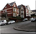
Christchurch Road houses alongside a steep ascent, Newport
by Jaggery geograph for square ST3288 Viewed from the corner of Summerhill Avenue. The houses are alongside
the long... (more)
Tags:
type:GeographX
top:Housing, DwellingsX
Long Steep AscentX
top:Roads, Road TransportX
Steep Ascent
|

|
Ascent towards Kilgetty
by Jaggery geograph for square SN1307 Part of the long ascent of Carmarthen Road from the A477 towards the eastern... (more)
Tags:
AscentX
type:GeographX
Long Steep AscentX
top:Roads, Road TransportX
Steep Ascent
top:Village, Rural SettlementX
|

|
Up the B4471, Llanhilleth
by Jaggery geograph for square SO2100 Steep ascent of the B4471 here named High Street Llanhilleth.
Tags:
road:B4471X
type:GeographX
street:High StreetX
Long Steep AscentX
top:Roads, Road TransportX
Steep Ascent
|

|
Steep ascent in Southerndown
by Jaggery geograph for square SS8873 Part of the 14% (1 in 7) ascent of Beach Road away from Dunraven Bay.
Tags:
type:GeographX
top:Roads, Road TransportX
Steep Ascent
Steep RoadX
top:Village, Rural SettlementX
|

|
Up Fochriw Road, Pontlottyn
by Jaggery geograph for square SO1105 Part of the long steep ascent of Fochriw Road from Pontlottyn to Fochriw.
Tags:
type:GeographX
top:Housing, DwellingsX
Long Steep AscentX
top:Roads, Road TransportX
Steep Ascent
top:Village, Rural SettlementX
|

|
Steep ascent from Somerset Street, Abertillery
by Jaggery geograph for square SO2103 One of many steep routes in Abertillery, this one is from Somerset Street to Queen Street.
|

|
Steep ascent, Graig Terrace, Bargoed
by Jaggery geograph for square SO1400 Up Graig Terrace towards Usk Road.
|

|
Steep ascent, Duffryn Street, Tir-y-berth
by Jaggery geograph for square ST1596 Duffryn Street ascends from Beatty Street toward Horner Street.
Tags:
type:GeographX
top:Housing, DwellingsX
top:Roads, Road TransportX
Steep Ascent
Steep RoadX
top:Village, Rural SettlementX
|

|
Steep ascent to Harry Roberts canal bridge near Pontymister
by Jaggery geograph for square ST2589 The approach to this side of the bridge contrasts with the gentle gradient on... (more)
Tags:
top:PathsX
Steep Ascent
|

|
Steep ascent, Ty Canol, Cwmbran
by Jaggery geograph for square ST2694 Path ascending from the SW side of Ty Canol Way.
|

|
Steep ascent, Hawkes Ridge, Ty Canol, Cwmbran
by Jaggery geograph for square ST2694 The road named Hawkes Ridge ascends from Ty Canol Way towards Celandine Court.
Tags:
type:GeographX
top:Housing, DwellingsX
top:Roads, Road TransportX
Steep Ascent
top:Suburb, Urban FringeX
|

|
Steep ascent, Commercial Road, Llanhilleth
by Jaggery geograph for square SO2100 Looking to the west up the B4471.
|

|
Steep ascent, Rhayader, Powys
by Jaggery geograph for square SN9768 The road from the A44 ascends towards Dark Lane.
|

|
Steep ascent, Church Lane, Llanddewi Rhydderch, Monmouthshire
by Jaggery geograph for square SO3512 Church Lane ascends from the south side of the main road through the village.
Tags:
lane:Church LaneX
type:GeographX
top:Roads, Road TransportX
Steep Ascent
top:Village, Rural SettlementX
|

|
Steep ascent away from Old Cwmbran
by Jaggery geograph for square ST2994 Commercial Street ascends towards Hill Top Road and St Dials Road.
St... (more)
|

|
Up Yewberry Lane, Newport
by Jaggery geograph for square ST3090 The start of the steep ascent of Yewberry Lane from Pillmawr Road in the Malpas... (more)
|

|
Steep ascent, High Street, Abersychan
by Jaggery geograph for square SO2603 Looking west up High Street from the corner of the A4043 Broad Street.
Double... (more)
Tags:
top:City, Town CentreX
Double Yellow LinesX
type:GeographX
street:High StreetX
top:Roads, Road TransportX
Steep Ascent
|

|
Steep ascent from Commercial Road, Machen
by Jaggery geograph for square ST2089 Siloam Hill ascends towards Napier Street.
|

|
Near the top of the steep ascent from Dunraven Bay, Beach Road, Southerndown
by Jaggery geograph for square SS8873 Looking towards the grey back of a sign showing a 14% (1 in 7) gradient.... (more)
|

|
Steep ascent, St Mary Street, Gilfach
by Jaggery for square ST1498 Viewed from the corner of St Anne Street.
Tags:
type:Cross GridX
top:Housing, DwellingsX
top:Roads, Road TransportX
Steep Ascent
top:Village, Rural SettlementX
|

|
Steep ascent into Tir-y-berth
by Jaggery geograph for square ST1596 Beatty Street from Fleur-de-lis passes the Tir-y-berth boundary sign.
Tags:
top:Boundary, BarrierX
type:GeographX
top:Roads, Road TransportX
Steep Ascent
Village Boundary SignX
top:Village, Rural SettlementX
|

|
Steep ascent in Machen
by Jaggery geograph for square ST2189 From the north side of the A468 Commercial Road, Alma Street ascends towards... (more)
Tags:
type:GeographX
top:Housing, DwellingsX
top:Roads, Road TransportX
Steep Ascent
top:Village, Rural SettlementX
|

|
Steep ascent, Lewis Street, Bedlinog
by Jaggery geograph for square SO0901 Lewis Street ascends from George Street towards Upper High Street and Pleasant View.
Tags:
type:GeographX
top:Housing, DwellingsX
top:Roads, Road TransportX
Steep Ascent
top:Village, Rural SettlementX
|

|
Steps up to Sunnyside, Ogmore Vale
by Jaggery geograph for square SS9389 Steep ascent from the east bank of the Ogwr Fawr river.
Tags:
type:GeographX
top:Housing, DwellingsX
top:PathsX
Steep Ascent
StepsX
top:Village, Rural SettlementX
|

|
Vicarage Lane, Pontlottyn
by Jaggery geograph for square SO1105 Steep ascent from the A469 opposite Greenfield Street.... (more)
Tags:
type:GeographX
subject:LaneX
LaneX
top:Roads, Road TransportX
Steep Ascent
top:Village, Rural SettlementX
|

|
Steep ascent away from Fochriw
by Jaggery geograph for square SO1005 The road south towards Bargoed climbs away from the centre of the village.
Tags:
type:GeographX
top:Housing, DwellingsX
top:Roads, Road TransportX
Steep Ascent
top:Village, Rural SettlementX
|

|
Steep ascent from the west side of Bailey Street, Deri
by Jaggery geograph for square SO1201 |

|
Steep ascent, Mill Road, Deri
by Jaggery geograph for square SO1201 Deri Broncos Rugby Football Club clubhouse... (more)
|

|
Up Church Street, New Quay
by Jaggery for square SN3859 Part of the steep ascent of the A486 Church Street away from the coast.
|

|
Steep ascent, Horner Street, Tir-y-berth
by Jaggery geograph for square ST1596 Viewed from the corner of Beatty Street. The Harris Coaches bus in the... (more)
Tags:
BusX
type:GeographX
Harris CoachesX
top:Housing, DwellingsX
top:Roads, Road TransportX
Steep Ascent
top:Village, Rural SettlementX
|

|
Steep ascent from Tylacelyn Road, Penygraig
by Jaggery geograph for square SS9991 An unnamed side street ascends from Tylacelyn Road to Hughes Street.
Tags:
type:GeographX
top:Housing, DwellingsX
Road JunctionX
top:Roads, Road TransportX
Steep Ascent
top:Village, Rural SettlementX
|

|
Steep ascent, Glannant Street, Penygraig
by Jaggery geograph for square SS9991 From Dinas Road. The white arrow on the blue sign points towards Tylacelyn Road shops.
|

|
Steep ascent along Alexandra Road, Pontycymer
by Jaggery geograph for square SS9091 Looking east from the corner of Oxford Street.
|

|
Small part of a long steep ascent from Cymmer to Trebanog
by Jaggery geograph for square ST0190 Looking up the A4233 Trebanog Road. A nearby sign shows a 16% gradient (between... (more)
|

|
Up Hengoed Road, Hengoed
by Jaggery geograph for square ST1495 Part of the long ascent of Hengoed Road towards Cefn Hengoed viewed from the... (more)
|

|
Ascent towards Ty Sign
by Jaggery geograph for square ST2490 Lower Wyndham Terrace ascends towards the white-on-green Ty Sign boundary sign.... (more)
|

|
Hilly Redcatch Road, Knowle, Bristol
by Jaggery geograph for square ST5970 Houses on the north side of Redcatch Road viewed from the corner of Wingfield Road.
Tags:
top:Housing, DwellingsX
top:Roads, Road TransportX
Steep Ascent
Steep HillX
top:Suburb, Urban FringeX
|

|
Up Alma Street, Machen
by Jaggery geograph for square ST2189 From the north side the A468 Commercial Road, Alma Street ascends towards Pandy... (more)
Tags:
type:GeographX
top:Housing, DwellingsX
top:Roads, Road TransportX
Steep Ascent
top:Village, Rural SettlementX
|

|
Up the B4255 High Street, Bedlinog
by Jaggery for square SO0901 A 14% (1 in 7) gradient sign Link is behind... (more)
Tags:
road:B4255X
type:Cross GridX
High StreetX
top:Roads, Road TransportX
Steep Ascent
top:Village, Rural SettlementX
|

|
Up Market Street, Ilfracombe
by Jaggery geograph for square SS5147 Market Street ascends from the south side of Wilder Road.
|

|
Up Pentrepiod Road, Pentrepiod, Torfaen
by Jaggery geograph for square SO2602 Pentrepiod Road west of the Chapel Road junction.
Signs indicate bend to the... (more)
|

|
Up High Street, Abersychan
by Jaggery geograph for square SO2603 High Street ascends away from Broad Street, past speed bumps.
|

|
Up Jones Street, Ynyswen
by Jaggery geograph for square SS9497 Viewed from the corner of Painters Row. Jones Street ascends past the Ynysfeio... (more)
Tags:
type:GeographX
top:Housing, DwellingsX
top:Roads, Road TransportX
Steep Ascent
top:Village, Rural SettlementX
|
