Quick filters:
Sarajevo bosnia map Stock Photos and Images
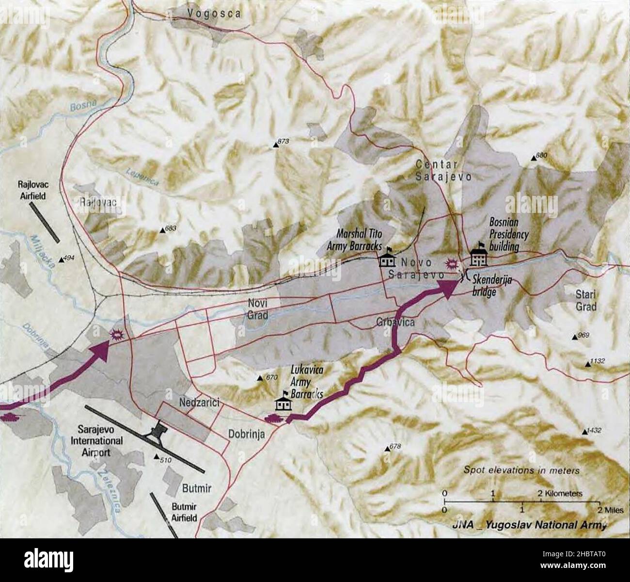 Sarajevo, Bosnia Map - May 2, 1992 Stock Photohttps://www.alamy.com/image-license-details/?v=1https://www.alamy.com/sarajevo-bosnia-map-may-2-1992-image454766144.html
RM2HBTAT0–Sarajevo, Bosnia Map - May 2, 1992
 Sarajevo Shown on a road map or Geography map Stock Photohttps://www.alamy.com/image-license-details/?v=1https://www.alamy.com/sarajevo-shown-on-a-road-map-or-geography-map-image410615449.html
RM2ET145D–Sarajevo Shown on a road map or Geography map
 Sarajevo Bosnia map Stock Photohttps://www.alamy.com/image-license-details/?v=1https://www.alamy.com/stock-photo-sarajevo-bosnia-map-125745922.html
RFH8G65P–Sarajevo Bosnia map
 Bosnia and Herzegovina political map with capital Sarajevo. Country in Southeastern Europe located on the Balkan Peninsula. Stock Photohttps://www.alamy.com/image-license-details/?v=1https://www.alamy.com/stock-photo-bosnia-and-herzegovina-political-map-with-capital-sarajevo-country-134386339.html
RFHPHR43–Bosnia and Herzegovina political map with capital Sarajevo. Country in Southeastern Europe located on the Balkan Peninsula.
 Bosnia and Herzegovina, Sarajevo - capital city, pinned on political map Stock Photohttps://www.alamy.com/image-license-details/?v=1https://www.alamy.com/bosnia-and-herzegovina-sarajevo-capital-city-pinned-on-political-map-image349031339.html
RF2B7RN0Y–Bosnia and Herzegovina, Sarajevo - capital city, pinned on political map
RFPAMXAH–Sarajevo city map with hand-drawn architecture icons. All drawigns, map and background separated for easy color change. Easy repositioning in vector v
 Administrative vector map of Sarajevo canton and city, Bosnia and Herzegovina Stock Photohttps://www.alamy.com/image-license-details/?v=1https://www.alamy.com/administrative-vector-map-of-sarajevo-canton-and-city-bosnia-and-herzegovina-image555166998.html
RF2R7614P–Administrative vector map of Sarajevo canton and city, Bosnia and Herzegovina
 SARAJEVO antique town city plan. Bosnia Herzegovina karta. BAEDEKER, 1905 map Stock Photohttps://www.alamy.com/image-license-details/?v=1https://www.alamy.com/stock-photo-sarajevo-antique-town-city-plan-bosnia-herzegovina-karta-baedeker-107887722.html
RFG7EKTX–SARAJEVO antique town city plan. Bosnia Herzegovina karta. BAEDEKER, 1905 map
 Sarajevo pinned on a map of Bosnia and Herzegovina Stock Photohttps://www.alamy.com/image-license-details/?v=1https://www.alamy.com/stock-photo-sarajevo-pinned-on-a-map-of-bosnia-and-herzegovina-125191834.html
RFH7JYCX–Sarajevo pinned on a map of Bosnia and Herzegovina
 Bosnia and Herzegovina map Stock Photohttps://www.alamy.com/image-license-details/?v=1https://www.alamy.com/stock-photo-bosnia-and-herzegovina-map-130698584.html
RFHGHRAG–Bosnia and Herzegovina map
 the tunnel, map of the siege, sarajevo, bosnia and herzegovina, europe Stock Photohttps://www.alamy.com/image-license-details/?v=1https://www.alamy.com/the-tunnel-map-of-the-siege-sarajevo-bosnia-and-herzegovina-europe-image67832574.html
RMDXA13X–the tunnel, map of the siege, sarajevo, bosnia and herzegovina, europe
 Sarajevo Bosnia and Herzegovina City Map in Retro Style. Outline Map. Vector Illustration. Stock Vectorhttps://www.alamy.com/image-license-details/?v=1https://www.alamy.com/sarajevo-bosnia-and-herzegovina-city-map-in-retro-style-outline-map-vector-illustration-image228175145.html
RFR767M9–Sarajevo Bosnia and Herzegovina City Map in Retro Style. Outline Map. Vector Illustration.
 Sarajevo map. Detailed map of Sarajevo city administrative area. Cityscape panorama. Royalty free vector illustration. Outline map with highways, stre Stock Vectorhttps://www.alamy.com/image-license-details/?v=1https://www.alamy.com/sarajevo-map-detailed-map-of-sarajevo-city-administrative-area-cityscape-panorama-royalty-free-vector-illustration-outline-map-with-highways-stre-image434072175.html
RF2G65KDK–Sarajevo map. Detailed map of Sarajevo city administrative area. Cityscape panorama. Royalty free vector illustration. Outline map with highways, stre
 Modern Map - Sarajevo BA Stock Vectorhttps://www.alamy.com/image-license-details/?v=1https://www.alamy.com/stock-photo-modern-map-sarajevo-ba-124643529.html
RFH6P02H–Modern Map - Sarajevo BA
 Bosnia And Herzegovina, Europe, True Colour Satellite Image With Border. Satellite view of Bosnia and Herzegovina (with border). Stock Photohttps://www.alamy.com/image-license-details/?v=1https://www.alamy.com/stock-photo-bosnia-and-herzegovina-europe-true-colour-satellite-image-with-border-71604645.html
RME4DTCN–Bosnia And Herzegovina, Europe, True Colour Satellite Image With Border. Satellite view of Bosnia and Herzegovina (with border).
 Sarajevo Bosnia and Herzegovina. Detailed Country Map with Location Pin on Capital City. Black silhouette and outline maps isolated on white backgroun Stock Vectorhttps://www.alamy.com/image-license-details/?v=1https://www.alamy.com/sarajevo-bosnia-and-herzegovina-detailed-country-map-with-location-pin-on-capital-city-black-silhouette-and-outline-maps-isolated-on-white-backgroun-image367442594.html
RF2C9PCNP–Sarajevo Bosnia and Herzegovina. Detailed Country Map with Location Pin on Capital City. Black silhouette and outline maps isolated on white backgroun
 Satellite view of Sarajevo the capital and largest city of Bosnia and Herzegovina. Map streets and buildings of the city Stock Vectorhttps://www.alamy.com/image-license-details/?v=1https://www.alamy.com/satellite-view-of-sarajevo-the-capital-and-largest-city-of-bosnia-and-herzegovina-map-streets-and-buildings-of-the-city-image381899726.html
RF2D590YX–Satellite view of Sarajevo the capital and largest city of Bosnia and Herzegovina. Map streets and buildings of the city
 Sarajevo map. Close up of Sarajevo map with red pin. Map with red pin point of Sarajevo in Bosnia and Herzegovina. Stock Photohttps://www.alamy.com/image-license-details/?v=1https://www.alamy.com/sarajevo-map-close-up-of-sarajevo-map-with-red-pin-map-with-red-pin-point-of-sarajevo-in-bosnia-and-herzegovina-image482662974.html
RF2K175FA–Sarajevo map. Close up of Sarajevo map with red pin. Map with red pin point of Sarajevo in Bosnia and Herzegovina.
 Vector map of Bosnia and Herzegovina with entities, cantons, regions and administrative divisions, and neighbouring countries and territories. Editabl Stock Vectorhttps://www.alamy.com/image-license-details/?v=1https://www.alamy.com/vector-map-of-bosnia-and-herzegovina-with-entities-cantons-regions-and-administrative-divisions-and-neighbouring-countries-and-territories-editabl-image629225413.html
RF2YFKKC5–Vector map of Bosnia and Herzegovina with entities, cantons, regions and administrative divisions, and neighbouring countries and territories. Editabl
 New York, USA - July 6, 2023: Bosnia Herzegovina country on map of apple ipad close up view Stock Photohttps://www.alamy.com/image-license-details/?v=1https://www.alamy.com/new-york-usa-july-6-2023-bosnia-herzegovina-country-on-map-of-apple-ipad-close-up-view-image558482722.html
RF2RCH2BE–New York, USA - July 6, 2023: Bosnia Herzegovina country on map of apple ipad close up view
 Sarajevo shown on a Road map or a geography map Stock Photohttps://www.alamy.com/image-license-details/?v=1https://www.alamy.com/sarajevo-shown-on-a-road-map-or-a-geography-map-image409163680.html
RM2ENK0CG–Sarajevo shown on a Road map or a geography map
 Guided Tour at the Tunnel Museum in Sarajevo Bosnia Stock Photohttps://www.alamy.com/image-license-details/?v=1https://www.alamy.com/stock-photo-guided-tour-at-the-tunnel-museum-in-sarajevo-bosnia-21758759.html
RMB7B5EF–Guided Tour at the Tunnel Museum in Sarajevo Bosnia
 Close-up of a red pushpin in a map of Sarajevo, Bosnia and Herzegovina. Stock Photohttps://www.alamy.com/image-license-details/?v=1https://www.alamy.com/stock-photo-close-up-of-a-red-pushpin-in-a-map-of-sarajevo-bosnia-and-herzegovina-96973226.html
RFFHNE9E–Close-up of a red pushpin in a map of Sarajevo, Bosnia and Herzegovina.
 Sarajevo Map, Map of Sarajevo, Sarajevo Print, Sarajevo Poster, Sarajevo City Plan, Sarajevo Maps, Sarajevo City Map, Old Bosnia and Herzegovina Map Stock Photohttps://www.alamy.com/image-license-details/?v=1https://www.alamy.com/sarajevo-map-map-of-sarajevo-sarajevo-print-sarajevo-poster-sarajevo-city-plan-sarajevo-maps-sarajevo-city-map-old-bosnia-and-herzegovina-map-image454174517.html
RF2HAWC6D–Sarajevo Map, Map of Sarajevo, Sarajevo Print, Sarajevo Poster, Sarajevo City Plan, Sarajevo Maps, Sarajevo City Map, Old Bosnia and Herzegovina Map
 Sarajevo Downtown 3D Vector Map of Famous Streets. Bright foreground full of colors. White Streets, Waterways and grey background areal. White Horizon Stock Vectorhttps://www.alamy.com/image-license-details/?v=1https://www.alamy.com/stock-photo-sarajevo-downtown-3d-vector-map-of-famous-streets-bright-foreground-147649399.html
RFJG608R–Sarajevo Downtown 3D Vector Map of Famous Streets. Bright foreground full of colors. White Streets, Waterways and grey background areal. White Horizon
 bosnia and herzegovina administrative and political vector map Stock Vectorhttps://www.alamy.com/image-license-details/?v=1https://www.alamy.com/bosnia-and-herzegovina-administrative-and-political-vector-map-image243637021.html
RFT4AHE5–bosnia and herzegovina administrative and political vector map
 YUGOSLAVIA WEST: Croatia Slovenia Bosnia; Inset Rijeka Sarajevo Zagreb, 1920 map Stock Photohttps://www.alamy.com/image-license-details/?v=1https://www.alamy.com/stock-photo-yugoslavia-west-croatia-slovenia-bosnia-inset-rijeka-sarajevo-zagreb-94287107.html
RFFDB44K–YUGOSLAVIA WEST: Croatia Slovenia Bosnia; Inset Rijeka Sarajevo Zagreb, 1920 map
 Sarajevo pinned on a map of Bosnia and Herzegovina Stock Photohttps://www.alamy.com/image-license-details/?v=1https://www.alamy.com/stock-photo-sarajevo-pinned-on-a-map-of-bosnia-and-herzegovina-125191835.html
RFH7JYCY–Sarajevo pinned on a map of Bosnia and Herzegovina
 Map of bosnia Stock Photohttps://www.alamy.com/image-license-details/?v=1https://www.alamy.com/map-of-bosnia-image67360497.html
RFDWGF01–Map of bosnia
 28th March 1993 During the Siege of Sarajevo: in Hadziristica Street,close to the Miljacka River, a big sign shows a town plan of the old city. In the background is a JAT (Yugoslav Airlines) office. Stock Photohttps://www.alamy.com/image-license-details/?v=1https://www.alamy.com/28th-march-1993-during-the-siege-of-sarajevo-in-hadziristica-streetclose-to-the-miljacka-river-a-big-sign-shows-a-town-plan-of-the-old-city-in-the-background-is-a-jat-yugoslav-airlines-office-image259264490.html
RMW1PEE2–28th March 1993 During the Siege of Sarajevo: in Hadziristica Street,close to the Miljacka River, a big sign shows a town plan of the old city. In the background is a JAT (Yugoslav Airlines) office.
 Sarajevo Bosnia and Herzegovina City Map in Retro Style. Outline Map. Vector Illustration. Stock Vectorhttps://www.alamy.com/image-license-details/?v=1https://www.alamy.com/stock-photo-sarajevo-bosnia-and-herzegovina-city-map-in-retro-style-outline-map-173000895.html
RFM1CTBB–Sarajevo Bosnia and Herzegovina City Map in Retro Style. Outline Map. Vector Illustration.
 Central Balkan Political Map Stock Photohttps://www.alamy.com/image-license-details/?v=1https://www.alamy.com/stock-photo-central-balkan-political-map-78834185.html
RFEG75PH–Central Balkan Political Map
 Bosnia and Herzgeovina map with flag Stock Photohttps://www.alamy.com/image-license-details/?v=1https://www.alamy.com/stock-photo-bosnia-and-herzgeovina-map-with-flag-130698585.html
RFHGHRAH–Bosnia and Herzgeovina map with flag
 Bosnia And Herzegovina, Europe, True Colour Satellite Image With Border And Mask. Satellite view of Bosnia and Herzegovina (with Stock Photohttps://www.alamy.com/image-license-details/?v=1https://www.alamy.com/stock-photo-bosnia-and-herzegovina-europe-true-colour-satellite-image-with-border-71604646.html
RME4DTCP–Bosnia And Herzegovina, Europe, True Colour Satellite Image With Border And Mask. Satellite view of Bosnia and Herzegovina (with
 Bosnia Herzegovina flag map on white background 3d illustration with clipping path Stock Photohttps://www.alamy.com/image-license-details/?v=1https://www.alamy.com/bosnia-herzegovina-flag-map-on-white-background-3d-illustration-with-clipping-path-image477937401.html
RF2JNFX0W–Bosnia Herzegovina flag map on white background 3d illustration with clipping path
 political, croatia, bosnia, map, atlas, map of the world, slovenia, travel, Stock Vectorhttps://www.alamy.com/image-license-details/?v=1https://www.alamy.com/stock-photo-political-croatia-bosnia-map-atlas-map-of-the-world-slovenia-travel-147060842.html
RFJF75GX–political, croatia, bosnia, map, atlas, map of the world, slovenia, travel,
 Detailed map of Sarajevo city administrative area. Royalty free vector illustration. Cityscape panorama. Decorative graphic tourist map of Sarajevo te Stock Vectorhttps://www.alamy.com/image-license-details/?v=1https://www.alamy.com/detailed-map-of-sarajevo-city-administrative-area-royalty-free-vector-illustration-cityscape-panorama-decorative-graphic-tourist-map-of-sarajevo-te-image395804291.html
RF2DYXCBF–Detailed map of Sarajevo city administrative area. Royalty free vector illustration. Cityscape panorama. Decorative graphic tourist map of Sarajevo te
 Vector map of Bosnia and Herzegovina with entities, cantons, regions and administrative divisions. Editable and clearly labeled layers. Stock Vectorhttps://www.alamy.com/image-license-details/?v=1https://www.alamy.com/vector-map-of-bosnia-and-herzegovina-with-entities-cantons-regions-and-administrative-divisions-editable-and-clearly-labeled-layers-image629229978.html
RF2YFKW76–Vector map of Bosnia and Herzegovina with entities, cantons, regions and administrative divisions. Editable and clearly labeled layers.
 3d isometric map of Sarajevo is a city of Bosnia, vector illustration Stock Vectorhttps://www.alamy.com/image-license-details/?v=1https://www.alamy.com/3d-isometric-map-of-sarajevo-is-a-city-of-bosnia-vector-illustration-image441611093.html
RF2GJD3CN–3d isometric map of Sarajevo is a city of Bosnia, vector illustration
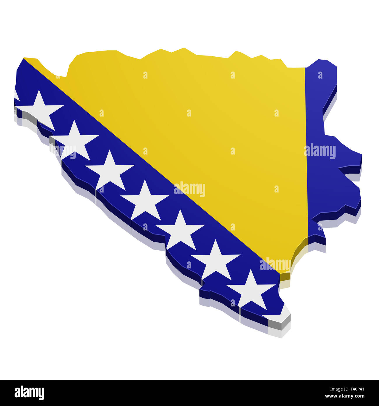 Map Bosnia Herzegowina Stock Photohttps://www.alamy.com/image-license-details/?v=1https://www.alamy.com/stock-photo-map-bosnia-herzegowina-88527825.html
RFF40P41–Map Bosnia Herzegowina
 Europe, map of Bosnia and Herzegovina Stock Photohttps://www.alamy.com/image-license-details/?v=1https://www.alamy.com/europe-map-of-bosnia-and-herzegovina-image353438487.html
RF2BF0EB3–Europe, map of Bosnia and Herzegovina
 Satellite Image Of Bosnia With Sarajevo Highlighted Stock Photohttps://www.alamy.com/image-license-details/?v=1https://www.alamy.com/satellite-image-of-bosnia-with-sarajevo-highlighted-image3503192.html
RFA3BG59–Satellite Image Of Bosnia With Sarajevo Highlighted
 A closeup of a finger pointing at Bosnia and Herzegovina on a world map Stock Photohttps://www.alamy.com/image-license-details/?v=1https://www.alamy.com/a-closeup-of-a-finger-pointing-at-bosnia-and-herzegovina-on-a-world-map-image476250735.html
RF2JJR2JR–A closeup of a finger pointing at Bosnia and Herzegovina on a world map
 Printable map of Sarajevo, Bosnia and Herzegovina with main and secondary roads and larger railways. This map is carefully designed for routing and pl Stock Vectorhttps://www.alamy.com/image-license-details/?v=1https://www.alamy.com/printable-map-of-sarajevo-bosnia-and-herzegovina-with-main-and-secondary-roads-and-larger-railways-this-map-is-carefully-designed-for-routing-and-pl-image241821379.html
RFT1BWHR–Printable map of Sarajevo, Bosnia and Herzegovina with main and secondary roads and larger railways. This map is carefully designed for routing and pl
 bosnia and herzegovina administrative and political vector map Stock Vectorhttps://www.alamy.com/image-license-details/?v=1https://www.alamy.com/bosnia-and-herzegovina-administrative-and-political-vector-map-image243579408.html
RFT4800G–bosnia and herzegovina administrative and political vector map
 Abstract vector color map of Federation Bosnia and Herzegovina Stock Vectorhttps://www.alamy.com/image-license-details/?v=1https://www.alamy.com/stock-photo-abstract-vector-color-map-of-federation-bosnia-and-herzegovina-107801439.html
RFG7ANRB–Abstract vector color map of Federation Bosnia and Herzegovina
 Sarajevo pinned on a map of europe Stock Photohttps://www.alamy.com/image-license-details/?v=1https://www.alamy.com/stock-photo-sarajevo-pinned-on-a-map-of-europe-72978044.html
RFE6MC6M–Sarajevo pinned on a map of europe
 City of Sarajevo, Bosnia and Herzogovina, City Map and Surroundings, Dinaric Mountains, Scale 1:80.000, City Districts, River Miljacka Stock Photohttps://www.alamy.com/image-license-details/?v=1https://www.alamy.com/city-of-sarajevo-bosnia-and-herzogovina-city-map-and-surroundings-dinaric-mountains-scale-180000-city-districts-river-miljacka-image505972227.html
RM2MB50MK–City of Sarajevo, Bosnia and Herzogovina, City Map and Surroundings, Dinaric Mountains, Scale 1:80.000, City Districts, River Miljacka
 Bosnia map. National map of the world. Gray colored countries map series. Stock Vectorhttps://www.alamy.com/image-license-details/?v=1https://www.alamy.com/bosnia-map-national-map-of-the-world-gray-colored-countries-map-series-image371105280.html
RF2CFN8G0–Bosnia map. National map of the world. Gray colored countries map series.
 Sarajevo Bosnia and Herzegovina City Map in Retro Style in Golden Color. Outline Map. Vector Illustration. Stock Vectorhttps://www.alamy.com/image-license-details/?v=1https://www.alamy.com/sarajevo-bosnia-and-herzegovina-city-map-in-retro-style-in-golden-color-outline-map-vector-illustration-image381515999.html
RF2D4KFFB–Sarajevo Bosnia and Herzegovina City Map in Retro Style in Golden Color. Outline Map. Vector Illustration.
 Bosnia map dotted on white background vector isolated. Illustration for technology design or infographics. Silhouette black and map pointer Stock Vectorhttps://www.alamy.com/image-license-details/?v=1https://www.alamy.com/bosnia-map-dotted-on-white-background-vector-isolated-illustration-for-technology-design-or-infographics-silhouette-black-and-map-pointer-image343363052.html
RF2AXHF24–Bosnia map dotted on white background vector isolated. Illustration for technology design or infographics. Silhouette black and map pointer
 Photo of Bosnia and Herzegovina marked by red flag in holder. Country on European continent. Stock Photohttps://www.alamy.com/image-license-details/?v=1https://www.alamy.com/stock-photo-photo-of-bosnia-and-herzegovina-marked-by-red-flag-in-holder-country-146991376.html
RFJF4100–Photo of Bosnia and Herzegovina marked by red flag in holder. Country on European continent.
 Bosnia And Herzegovina, Europe, True Colour Satellite Image With Mask. Satellite view of Bosnia and Herzegovina (with mask). Thi Stock Photohttps://www.alamy.com/image-license-details/?v=1https://www.alamy.com/stock-photo-bosnia-and-herzegovina-europe-true-colour-satellite-image-with-mask-71605446.html
RME4DWDA–Bosnia And Herzegovina, Europe, True Colour Satellite Image With Mask. Satellite view of Bosnia and Herzegovina (with mask). Thi
 Bosnia and Herzegovina outlined on a high resolution satellite map Stock Photohttps://www.alamy.com/image-license-details/?v=1https://www.alamy.com/bosnia-and-herzegovina-outlined-on-a-high-resolution-satellite-map-image591178093.html
RF2W9PDK9–Bosnia and Herzegovina outlined on a high resolution satellite map
 bosnia, map, atlas, map of the world, travel, europe, adriatic sea, croatia, Stock Vectorhttps://www.alamy.com/image-license-details/?v=1https://www.alamy.com/stock-photo-bosnia-map-atlas-map-of-the-world-travel-europe-adriatic-sea-croatia-147061672.html
RFJF76JG–bosnia, map, atlas, map of the world, travel, europe, adriatic sea, croatia,
 Urban city map of Sarajevo. Vector illustration, Sarajevo map grayscale art poster. Street map image with roads, metropolitan city area view. Stock Vectorhttps://www.alamy.com/image-license-details/?v=1https://www.alamy.com/urban-city-map-of-sarajevo-vector-illustration-sarajevo-map-grayscale-art-poster-street-map-image-with-roads-metropolitan-city-area-view-image395804262.html
RF2DYXCAE–Urban city map of Sarajevo. Vector illustration, Sarajevo map grayscale art poster. Street map image with roads, metropolitan city area view.
 Vector illustrated map of Bosnia and Herzegovina with entities, cantons, regions and administrative divisions, and neighbouring countries and territor Stock Vectorhttps://www.alamy.com/image-license-details/?v=1https://www.alamy.com/vector-illustrated-map-of-bosnia-and-herzegovina-with-entities-cantons-regions-and-administrative-divisions-and-neighbouring-countries-and-territor-image629230253.html
RF2YFKWH1–Vector illustrated map of Bosnia and Herzegovina with entities, cantons, regions and administrative divisions, and neighbouring countries and territor
 Highly detailed physical map of the Bosnia and Herzegovina,in vector format,with all the relief forms,regions and big cities. Stock Vectorhttps://www.alamy.com/image-license-details/?v=1https://www.alamy.com/highly-detailed-physical-map-of-the-bosnia-and-herzegovinain-vector-formatwith-all-the-relief-formsregions-and-big-cities-image468042259.html
RF2J5D4JY–Highly detailed physical map of the Bosnia and Herzegovina,in vector format,with all the relief forms,regions and big cities.
 Bosnia and Herzegovina high detailed vector representation of country silhouette in solid black on white background. For educational, decorative, or informational use showcasing the national outline. Stock Vectorhttps://www.alamy.com/image-license-details/?v=1https://www.alamy.com/bosnia-and-herzegovina-high-detailed-vector-representation-of-country-silhouette-in-solid-black-on-white-background-for-educational-decorative-or-informational-use-showcasing-the-national-outline-image636779396.html
RF2YYYPH8–Bosnia and Herzegovina high detailed vector representation of country silhouette in solid black on white background. For educational, decorative, or informational use showcasing the national outline.
 Europe, map of Bosnia and Herzegovina Stock Photohttps://www.alamy.com/image-license-details/?v=1https://www.alamy.com/europe-map-of-bosnia-and-herzegovina-image353438472.html
RF2BF0EAG–Europe, map of Bosnia and Herzegovina
 Extruded 3D political Map of Bosnia and Herzegovina with relief as marble sculpture on a light beige background Stock Photohttps://www.alamy.com/image-license-details/?v=1https://www.alamy.com/extruded-3d-political-map-of-bosnia-and-herzegovina-with-relief-as-marble-sculpture-on-a-light-beige-background-image328279051.html
RF2A22B7R–Extruded 3D political Map of Bosnia and Herzegovina with relief as marble sculpture on a light beige background
 Vector map of Bosnia and Herzegovina municipalities. Sarajevo cityscape. Flag of Bosnia and Herzegovina Stock Vectorhttps://www.alamy.com/image-license-details/?v=1https://www.alamy.com/vector-map-of-bosnia-and-herzegovina-municipalities-sarajevo-cityscape-flag-of-bosnia-and-herzegovina-image388255178.html
RF2DFJFCA–Vector map of Bosnia and Herzegovina municipalities. Sarajevo cityscape. Flag of Bosnia and Herzegovina
 Bosnia And Herzegovina Political Map Stock Photohttps://www.alamy.com/image-license-details/?v=1https://www.alamy.com/stock-photo-bosnia-and-herzegovina-political-map-78795864.html
RFEG5CX0–Bosnia And Herzegovina Political Map
RF2S07BHC–Pixelated world map icons in 8-bit style, featuring over 190 countries. Perfect for digital art, educational projects, and themed designs.
 Watching the map of the Siege of Sarajevo in the courthouse of Kolar family house, now Sarajevo Tunnel Museum housing the 1993 underground tunnel Stock Photohttps://www.alamy.com/image-license-details/?v=1https://www.alamy.com/watching-the-map-of-the-siege-of-sarajevo-in-the-courthouse-of-kolar-family-house-now-sarajevo-tunnel-museum-housing-the-1993-underground-tunnel-image223496787.html
RFPYH4C3–Watching the map of the Siege of Sarajevo in the courthouse of Kolar family house, now Sarajevo Tunnel Museum housing the 1993 underground tunnel
 Sarajevo pinned on a map of europe Stock Photohttps://www.alamy.com/image-license-details/?v=1https://www.alamy.com/stock-photo-sarajevo-pinned-on-a-map-of-europe-72978000.html
RFE6MC54–Sarajevo pinned on a map of europe
 Bosnia and Herzegovina map Stock Photohttps://www.alamy.com/image-license-details/?v=1https://www.alamy.com/stock-photo-bosnia-and-herzegovina-map-115214663.html
RFGKCDDB–Bosnia and Herzegovina map
 Bosnia and Herzegovina outline map Stock Vectorhttps://www.alamy.com/image-license-details/?v=1https://www.alamy.com/stock-image-bosnia-and-herzegovina-outline-map-167631048.html
RFKMM734–Bosnia and Herzegovina outline map
 Sarajevo Bosnia and Herzegovina City Map in Black and White Color in Retro Style. Outline Map. Vector Illustration. Stock Vectorhttps://www.alamy.com/image-license-details/?v=1https://www.alamy.com/sarajevo-bosnia-and-herzegovina-city-map-in-black-and-white-color-in-retro-style-outline-map-vector-illustration-image477791396.html
RF2JN97PC–Sarajevo Bosnia and Herzegovina City Map in Black and White Color in Retro Style. Outline Map. Vector Illustration.
 Bosnia and Herzegovina Map Flag. Map of Bosnia and Herzegovina with country flag. Vector Illustration. Stock Vectorhttps://www.alamy.com/image-license-details/?v=1https://www.alamy.com/bosnia-and-herzegovina-map-flag-map-of-bosnia-and-herzegovina-with-country-flag-vector-illustration-image465272183.html
RF2J0XYBK–Bosnia and Herzegovina Map Flag. Map of Bosnia and Herzegovina with country flag. Vector Illustration.
 Sarajevo Travel Secrets Art Map for mapping experts and travel guides. Handmade city logo, typo badge and hand drawn vector image on top are grouped a Stock Vectorhttps://www.alamy.com/image-license-details/?v=1https://www.alamy.com/stock-photo-sarajevo-travel-secrets-art-map-for-mapping-experts-and-travel-guides-147802705.html
RFJGCYT1–Sarajevo Travel Secrets Art Map for mapping experts and travel guides. Handmade city logo, typo badge and hand drawn vector image on top are grouped a
 Bosnia and Herzegovina, Relief Map With Border Stock Photohttps://www.alamy.com/image-license-details/?v=1https://www.alamy.com/stock-photo-bosnia-and-herzegovina-relief-map-with-border-71605905.html
RME4DX1N–Bosnia and Herzegovina, Relief Map With Border
 Bosnia and Herzegovina highlighted on a low resolution satellite map Stock Photohttps://www.alamy.com/image-license-details/?v=1https://www.alamy.com/bosnia-and-herzegovina-highlighted-on-a-low-resolution-satellite-map-image591178020.html
RF2W9PDGM–Bosnia and Herzegovina highlighted on a low resolution satellite map
 central, kosovo, states, balkans, bosnia, map, atlas, map of the world, serbia, Stock Vectorhttps://www.alamy.com/image-license-details/?v=1https://www.alamy.com/stock-photo-central-kosovo-states-balkans-bosnia-map-atlas-map-of-the-world-serbia-147061724.html
RFJF76MC–central, kosovo, states, balkans, bosnia, map, atlas, map of the world, serbia,
 Sarajevo map. Detailed vector map of Sarajevo city administrative area. Cityscape poster metropolitan aria view. Dark land with white streets, roads a Stock Vectorhttps://www.alamy.com/image-license-details/?v=1https://www.alamy.com/sarajevo-map-detailed-vector-map-of-sarajevo-city-administrative-area-cityscape-poster-metropolitan-aria-view-dark-land-with-white-streets-roads-a-image395800660.html
RF2DYX7NT–Sarajevo map. Detailed vector map of Sarajevo city administrative area. Cityscape poster metropolitan aria view. Dark land with white streets, roads a
 Vector map of Bosnia and Herzegovina with entities, cantons, regions and administrative divisions. Editable and clearly labeled layers. Stock Vectorhttps://www.alamy.com/image-license-details/?v=1https://www.alamy.com/vector-map-of-bosnia-and-herzegovina-with-entities-cantons-regions-and-administrative-divisions-editable-and-clearly-labeled-layers-image629232027.html
RF2YFKYTB–Vector map of Bosnia and Herzegovina with entities, cantons, regions and administrative divisions. Editable and clearly labeled layers.
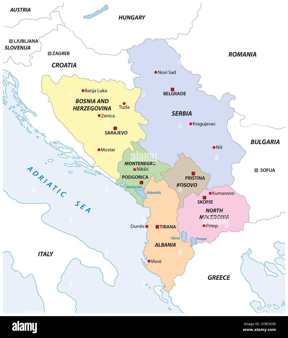 Map of the Western Balkan states Stock Photohttps://www.alamy.com/image-license-details/?v=1https://www.alamy.com/map-of-the-western-balkan-states-image626613260.html
RF2YBCKH0–Map of the Western Balkan states
 Bobsled inside the Olympic Museum in the city of Sarajevo, August 30, 2023 Stock Photohttps://www.alamy.com/image-license-details/?v=1https://www.alamy.com/bobsled-inside-the-olympic-museum-in-the-city-of-sarajevo-august-30-2023-image563613432.html
RF2RMXPK4–Bobsled inside the Olympic Museum in the city of Sarajevo, August 30, 2023
 Europe, map of Bosnia and Herzegovina Stock Photohttps://www.alamy.com/image-license-details/?v=1https://www.alamy.com/europe-map-of-bosnia-and-herzegovina-image353438481.html
RF2BF0EAW–Europe, map of Bosnia and Herzegovina
 Bosnia and Herzegovina set of three maps - solid map, outline map and map highlighting administrative divisions. Three distinct maps illustrate various representations of a geographical area. Stock Vectorhttps://www.alamy.com/image-license-details/?v=1https://www.alamy.com/bosnia-and-herzegovina-set-of-three-maps-solid-map-outline-map-and-map-highlighting-administrative-divisions-three-distinct-maps-illustrate-various-representations-of-a-geographical-area-image637674252.html
RF2S1CG0C–Bosnia and Herzegovina set of three maps - solid map, outline map and map highlighting administrative divisions. Three distinct maps illustrate various representations of a geographical area.
 Bosnia and Herzegovina, Sarajevo - national flag pinned on political map - 3D illustration Stock Photohttps://www.alamy.com/image-license-details/?v=1https://www.alamy.com/bosnia-and-herzegovina-sarajevo-national-flag-pinned-on-political-map-3d-illustration-image591410346.html
RF2WA51X2–Bosnia and Herzegovina, Sarajevo - national flag pinned on political map - 3D illustration
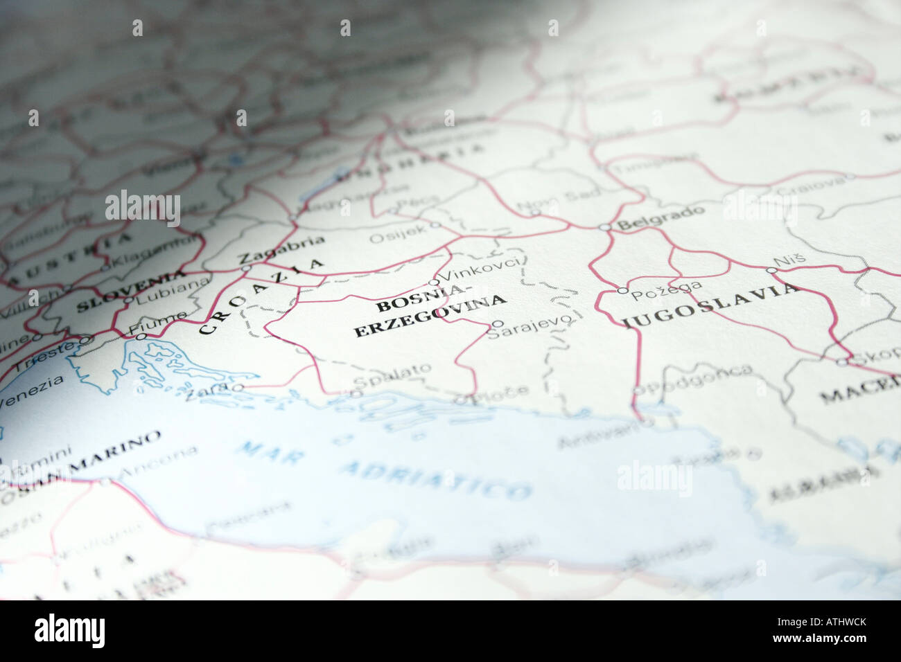 Ex Yugoslavia map Stock Photohttps://www.alamy.com/image-license-details/?v=1https://www.alamy.com/stock-photo-ex-yugoslavia-map-16325154.html
RMATHWCK–Ex Yugoslavia map
 The contours of territory of Bosnia and Herzegovina in grey colours and word Bosnia and Herzegovina in colors of the oficial flag, blue, yellow and wh Stock Vectorhttps://www.alamy.com/image-license-details/?v=1https://www.alamy.com/the-contours-of-territory-of-bosnia-and-herzegovina-in-grey-colours-and-word-bosnia-and-herzegovina-in-colors-of-the-oficial-flag-blue-yellow-and-wh-image238016302.html
RFRR6G66–The contours of territory of Bosnia and Herzegovina in grey colours and word Bosnia and Herzegovina in colors of the oficial flag, blue, yellow and wh
 Watching the map of the Siege of Sarajevo in the courthouse of Kolar family house, now Sarajevo Tunnel Museum housing the 1993 underground tunnel Stock Photohttps://www.alamy.com/image-license-details/?v=1https://www.alamy.com/watching-the-map-of-the-siege-of-sarajevo-in-the-courthouse-of-kolar-family-house-now-sarajevo-tunnel-museum-housing-the-1993-underground-tunnel-image223496786.html
RFPYH4C2–Watching the map of the Siege of Sarajevo in the courthouse of Kolar family house, now Sarajevo Tunnel Museum housing the 1993 underground tunnel
 Highlighted Satellite Image Of Bosnia Herzegovina With Banja Luka And Sarajevo Shown Stock Photohttps://www.alamy.com/image-license-details/?v=1https://www.alamy.com/highlighted-satellite-image-of-bosnia-herzegovina-with-banja-luka-image3618793.html
RFA4MREA–Highlighted Satellite Image Of Bosnia Herzegovina With Banja Luka And Sarajevo Shown
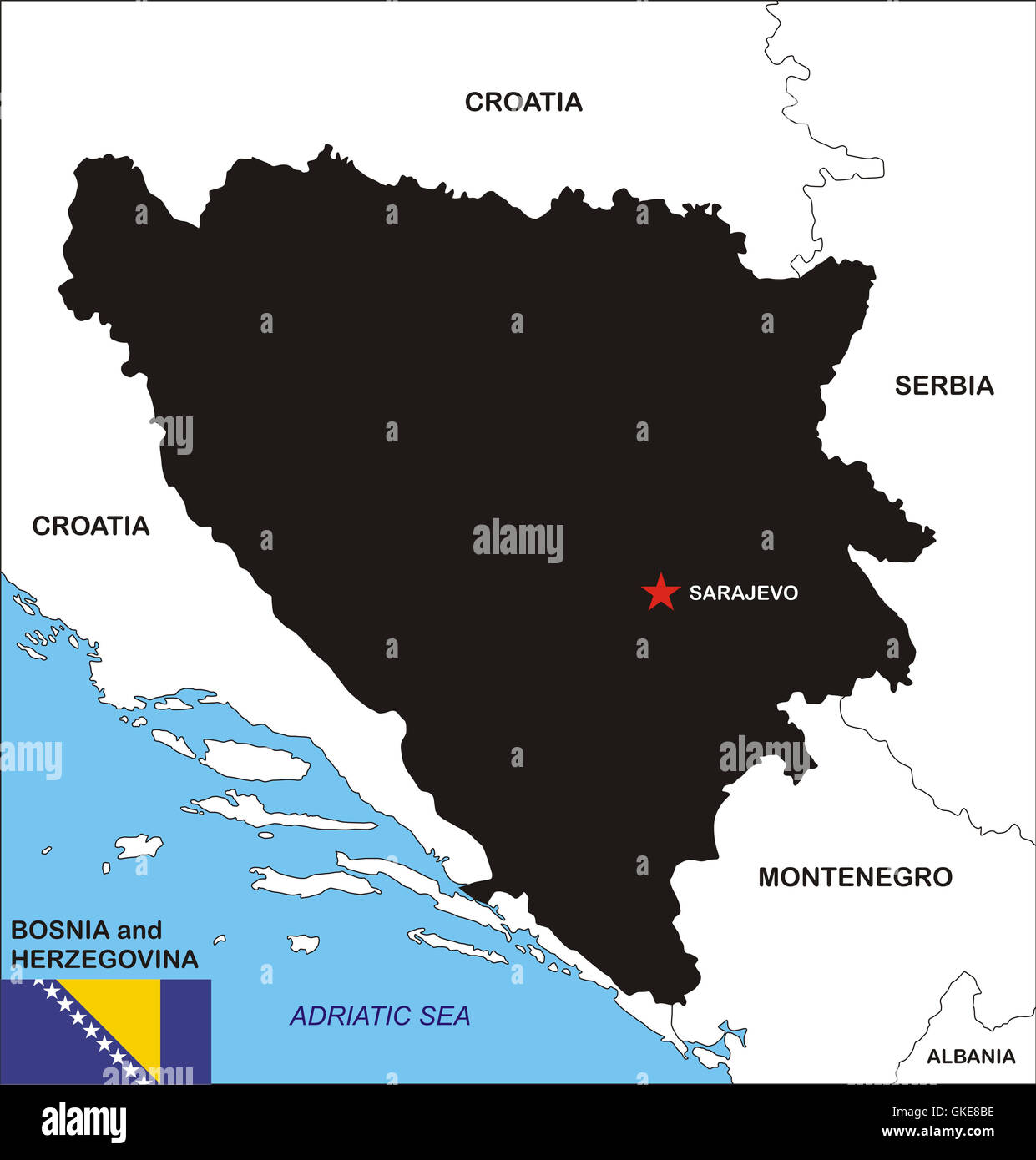 Bosnia and Herzegovina map Stock Photohttps://www.alamy.com/image-license-details/?v=1https://www.alamy.com/stock-photo-bosnia-and-herzegovina-map-115254594.html
RFGKE8BE–Bosnia and Herzegovina map
 Contour map of Bosnia and Herzegovina with a technological electronics circuit. Stock Vectorhttps://www.alamy.com/image-license-details/?v=1https://www.alamy.com/contour-map-of-bosnia-and-herzegovina-with-a-technological-electronics-circuit-image448018326.html
RF2H0TYXE–Contour map of Bosnia and Herzegovina with a technological electronics circuit.
 Sarajevo Bosnia and Herzegovina City Map in Black and White Color in Retro Style Isolated on White. Outline Map. Vector Illustration. Stock Vectorhttps://www.alamy.com/image-license-details/?v=1https://www.alamy.com/sarajevo-bosnia-and-herzegovina-city-map-in-black-and-white-color-in-retro-style-isolated-on-white-outline-map-vector-illustration-image477775816.html
RF2JN8FX0–Sarajevo Bosnia and Herzegovina City Map in Black and White Color in Retro Style Isolated on White. Outline Map. Vector Illustration.
 Bosnia and Herzegovina Map Flag. Map of Bosnia and Herzegovina with national flag isolated on white background. Vector Illustration. Stock Vectorhttps://www.alamy.com/image-license-details/?v=1https://www.alamy.com/bosnia-and-herzegovina-map-flag-map-of-bosnia-and-herzegovina-with-national-flag-isolated-on-white-background-vector-illustration-image417019401.html
RF2F6CTE1–Bosnia and Herzegovina Map Flag. Map of Bosnia and Herzegovina with national flag isolated on white background. Vector Illustration.
 Bosnia and Herzegovina Magnified Map and Flag, Vector Art Stock Vectorhttps://www.alamy.com/image-license-details/?v=1https://www.alamy.com/bosnia-and-herzegovina-magnified-map-and-flag-vector-art-image622816364.html
RF2Y57MHG–Bosnia and Herzegovina Magnified Map and Flag, Vector Art
 Bosnia and Herzegovina, Relief Map With Border and Mask Stock Photohttps://www.alamy.com/image-license-details/?v=1https://www.alamy.com/stock-photo-bosnia-and-herzegovina-relief-map-with-border-and-mask-71601587.html
RME4DMFF–Bosnia and Herzegovina, Relief Map With Border and Mask
 Bosnia and Herzegovina highlighted on a high resolution satellite map Stock Photohttps://www.alamy.com/image-license-details/?v=1https://www.alamy.com/bosnia-and-herzegovina-highlighted-on-a-high-resolution-satellite-map-image591178009.html
RF2W9PDG9–Bosnia and Herzegovina highlighted on a high resolution satellite map
 Bosnia and Herzegovina map vector illustration. Global economy. Famous country. Southern Europe. Europe. Stock Vectorhttps://www.alamy.com/image-license-details/?v=1https://www.alamy.com/bosnia-and-herzegovina-map-vector-illustration-global-economy-famous-country-southern-europe-europe-image499531588.html
RF2M0KHHT–Bosnia and Herzegovina map vector illustration. Global economy. Famous country. Southern Europe. Europe.
 3d isometric map of Sarajevo City is a Capital of Bosnia, vector illustration Stock Vectorhttps://www.alamy.com/image-license-details/?v=1https://www.alamy.com/3d-isometric-map-of-sarajevo-city-is-a-capital-of-bosnia-vector-illustration-image417120902.html
RF2F6HDY2–3d isometric map of Sarajevo City is a Capital of Bosnia, vector illustration
 Vector blank map of Bosnia and Herzegovina with entities, cantons, regions and administrative divisions. Editable and clearly labeled layers. Stock Vectorhttps://www.alamy.com/image-license-details/?v=1https://www.alamy.com/vector-blank-map-of-bosnia-and-herzegovina-with-entities-cantons-regions-and-administrative-divisions-editable-and-clearly-labeled-layers-image629222294.html
RF2YFKFCP–Vector blank map of Bosnia and Herzegovina with entities, cantons, regions and administrative divisions. Editable and clearly labeled layers.
 Bosnia and Herzegovina map Stock Vectorhttps://www.alamy.com/image-license-details/?v=1https://www.alamy.com/bosnia-and-herzegovina-map-image366081757.html
RF2C7GD0D–Bosnia and Herzegovina map
 3d rendering of Bosnia Herzegovina map and flag on background. Stock Photohttps://www.alamy.com/image-license-details/?v=1https://www.alamy.com/stock-photo-3d-rendering-of-bosnia-herzegovina-map-and-flag-on-background-121049412.html
RFH0X7N8–3d rendering of Bosnia Herzegovina map and flag on background.
 Map of Sarajevo at the war tunnel museum showing how city was surrounded by Serbian forces in the war of 1992-1995. Sarajevo, Bosnia and Herzegovina. Stock Photohttps://www.alamy.com/image-license-details/?v=1https://www.alamy.com/stock-photo-map-of-sarajevo-at-the-war-tunnel-museum-showing-how-city-was-surrounded-139833430.html
RFJ3DXY2–Map of Sarajevo at the war tunnel museum showing how city was surrounded by Serbian forces in the war of 1992-1995. Sarajevo, Bosnia and Herzegovina.
 Bosnia and Herzegovina set of three maps - solid map, outline map and map highlighting administrative divisions. Three distinct maps illustrate various representations of a geographical area. Stock Vectorhttps://www.alamy.com/image-license-details/?v=1https://www.alamy.com/bosnia-and-herzegovina-set-of-three-maps-solid-map-outline-map-and-map-highlighting-administrative-divisions-three-distinct-maps-illustrate-various-representations-of-a-geographical-area-image636854739.html
RF2S036M3–Bosnia and Herzegovina set of three maps - solid map, outline map and map highlighting administrative divisions. Three distinct maps illustrate various representations of a geographical area.
