Peterborough
Peterborough | |
|---|---|
 | |
| Motto: "Upon this rock I will build my church" (Upon this rock) | |
 Peterborough Unitary Authority Area shown within Cambridgeshire | |
| Coordinates: 52°34′21″N 00°14′35″W / 52.57250°N 0.24306°W | |
| Sovereign state | United Kingdom |
| Constituent country | England |
| Region | East of England |
| Ceremonial county | Cambridgeshire |
| Admin HQ | Peterborough |
| City status | 1541[1] |
| Incorporated | 1874 |
| Unitary | 1998 |
| Government | |
| • Type | Non-metropolitan district |
| • Governing body | Peterborough City Council |
| • Leadership | Leader and Cabinet |
| • Executive | Conservative |
| • MPs | Stewart Jackson (Con) Shailesh Vara (Con) |
| Area | |
| • Total | 132.58 sq mi (343.38 km2) |
| Population (2005 est.) | |
| • Total | 197,100 |
| • Density | 1,480/sq mi (573/km2) |
| • Ethnicity | 82.5% White 11.7% Asian 2.3% Black 0.8% Other 2.8% Mixed |
| Time zone | UTC±0 (GMT) |
| • Summer (DST) | UTC+1 (BST) |
| Postcode area | |
| Area code | 01733 |
| ISO 3166-2 | GB-PTE |
| ONS code | 00JA (ONS) E06000031 (GSS) |
| OS grid reference | TL185998 |
| NUTS 3 | UKH11 |
| Website | www.peterborough.gov.uk |
Peterborough (/ˈpiːtərbrə/ or /ˈpiːtərbərə/ (![]() listen)) is a cathedral city in the East of England. The population is about 184,500 as of mid–2011. The city is well known for its cathedral.
listen)) is a cathedral city in the East of England. The population is about 184,500 as of mid–2011. The city is well known for its cathedral.
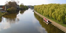
Even though it is part of Northamptonshire, for ceremonial purposes it is inside the county of Cambridgeshire. The city is 75 miles (121 km) north of London. It is on the River Nene which flows into the North Sea, about 30 miles (48 km) to the north-east.
The railway station is an important stop on the East Coast Main Line between London and Edinburgh. The local government area includes Northamptonshire and Rutland to the west, Lincolnshire to the north, and non-metropolitan Cambridgeshire to the south and east.
The topography of the land is flat. In some places it is below sea level, for example in the Fens that are east of Peterborough.
Human settlement began before the Bronze Age, as seen at the Flag Fen archaeological site to the east. There is also evidence of Roman occupation. In the Anglo-Saxon English period of time, a monastery, Medeshamstede was built. This later became Peterborough Cathedral.
The population grew fast after rail transport began in the 19th century. At that time, Peterborough became known for the manufacturing of bricks.


Population growth
[change | change source]After World War II, the city did not grow much, until the 1960s. Peterborough was named a "New Town" in 1967, by the government. This was part of the New Towns Act of 1946. It planned new towns to move people into better homes, who were still living in poor or bombed-out housing from the war.
Housing and population are still growing in the 21st century. Peterborough's population growth was the fastest of any British city over the ten years from 2002. This was partly due to immigration.[3]
Because the city is still getting larger, the city council has passed a law for a new development plan.[4] This is to add an additional 22,000 homes, 18,000 jobs and over 40,000 people who will live in Peterborough by 2020. The newly developing Hampton township will be finished. There will also be a 1,500-homes built in Stanground, and a 1,200-homes built in Paston.
Suburbs
[change | change source]Parnwell
[change | change source]Parnwell is a housing estate in the east of the city. Situated off Parnwell Way, it is easily accessible using the Frank Perkins Way (A1139). It is served by a convenience store at the Parnwell Centre and has a Sure Start Centre and a health centre.
The local primary school is Parnwell Primary School, which was opened in 1989 to serve children from 4 to 11 years. Children over this age may choose to attend the City of Peterborough Academy (COPA), Thomas Deacon Academy or the Stanground Academy.
References
[change | change source]- ↑ Beckett, John V. City Status in the British Isles, 1830–2002 (p.14) Ashgate Publishing, Aldershot, 2005. Retrieved 14 June 2015
- ↑ Grant of arms by letters patent sealed by Garter, Clarenceux and Norroy & Ulster Kings of Arms dated 6 September 1960.
- ↑ Grinnell, Paul (29 January 2014). "Population growth rate is fastest in UK but Peterborough people are not that happy - report". Peterborough Telegraph. Archived from the original on 21 May 2015. Retrieved 14 June 2015.
- ↑ Peterborough Local Plan (First Replacement)[permanent dead link] Peterborough City Council, July 2005. retrieved 14 June 2015
