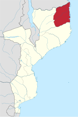
Cabo Delgado Province
Appearance
Cabo Delgado | |
|---|---|
 | |
 Cabo Delgado, Province of Mozambique | |
| Country | Mozambique |
| Capital | Pemba |
| Area | |
| • Total | 82,625 km2 (31,902 sq mi) |
| Population (2017) | |
| • Total | 2,320,261 |
| • Density | 28/km2 (73/sq mi) |
| Postal code | 32xxx |
| Area code | (+258) 278 |
| Website | www |
Cabo Delgado is a province of Mozambique. The capital is Pemba.
Districts
[change | change source]Cabo Delgado Province is divided into the 16 districts of:
- Ancuabe District – covering 4,606 km² with 109,792 people,
- Balama District – covering 5,619 km² with 126,116 people,
- Chiúre District – covering 4,210 km² with 230,044 people,
- Ibo District – covering just 48 km² with 9,509 people,
- Macomia District – covering 4,049 km² with 81,208 people,
- Mecúfi District – covering 1,192 km² with 43,573 people,
- Meluco District – covering 5,799 km² with 25,184 people,
- Mocímboa da Praia District – covering 3,548 km² with 94,197 people,
- Montepuez District – covering 15,871 km² with 185,635 people,
- Mueda District – covering 14,150 km² with 120,067 people,
- Muidumbe District – covering 1,987 km² with 73,457 people,
- Namuno District – covering 6,915 km² with 179,992 people,
- Nangade District – covering 3,031 km² with 63,739 people,
- Palma District – covering 3,493 km² with 48,423 people,
- Pemba-Metuge District – covering 1,094 km² with 65,365 people (excluding the city of Pemba),
- Quissanga District – covering 2,061 km² with 35,192 people;
and the municipalities of:
- Mocimboa da Praia
- Montepuez
- Pemba – covering 194 km² with 141,316 people
