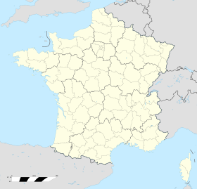
Gignac-la-Nerthe
Izgled
| Žinjak la Nert Gignac-la-Nerthe | |
|---|---|
 Grb | |
| Osnovni podaci | |
| Država | |
| Region | Provansa-Alpi-Azurna obala |
| Departman | Bouches-du-Rhône |
| Stanovništvo | |
| Stanovništvo (2011-01-01) | 9.055[1] |
| Gustina stanovništva | 1048,03 st./km² |
| Geografija | |
| Koordinate | 43°23′39″N 5°14′12″E / 43.3941666667°N 5.23666666667°E |
| Vremenska zona | UTC+1, ljeti UTC+2 |
| Površina | 8,64 km² |
| Ostali podaci | |
| Poštanski kod | 13180 |
| INSEE kod | 13043 |
Žinjak la Nert (fr. Gignac-la-Nerthe) je naseljeno mesto u Francuskoj u regionu Provansa-Alpi-Azurna obala, u departmanu Ušće Rone.
Po podacima iz 1990. godine broj stanovnika u mestu je bio 8.772, a gustina naseljenosti je iznosila 1,015 stanovnika/km².
- Alexandra Hughes, Alex Hughes, Keith A Reader, Keith Reader, ur. (2001). Encyclopedia of Contemporary French Culture (Routledge; Routledge World Reference edition izd.). ISBN 0415263549.
- Robb, Graham (2008). The Discovery of France: A Historical Geography. W. W. Norton & Company. ISBN 0393333647.
- Ardagh, John (1991). France (Cultural Atlas of izd.). Facts on File. ISBN 081602619X.
- Jones, Colin (1999). The Cambridge Illustrated History of France (Cambridge Illustrated Histories izd.). Cambridge University Press. ISBN 0521669928.
- Sowerwine, Charles (2009). France since 1870: Culture, Society and the Making of the Republic (2nd izd.). Palgrave Macmillan. ISBN 0230573398.
- Roberts, William J. (2004). France: A Reference Guide from the Renaissance to the Present (European Nations) (European Nations izd.). Facts on File. ISBN 0816044732.
- Izvor podataka: Insee
- Mape i satelitski snimci:
- Google maps
- MSN-ov atlas sveta Arhivirano 2006-01-26 na Wayback Machine-u


