Tagaytay
Appearance
Tagaytay | |
|---|---|
 | |
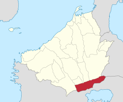
 Mapa ning Cavite ampong Tagaytay ilage | |
 | |
| Puuk: 14°6'N, 120°56'E | |
| Bansa | Filipinas |
| Labuad | Calabarzon (Rehiyong IV-A) |
| Lalawigan | Cavite |
| Tuknangan | Lakanbalen |
| Mitatag | Juniu 21, 1938 |
| Barangay | 34 |
| Sukad | |
| • Kabilugan | 65.00 km2 (25.10 sq mi) |
| Elebasyun | 292 m (958 ft) |
| Populasyun (Sensu ning 1 Mayu 2020) | |
| • Kabilugan | 85,330 |
| • Densidad | 1,300/km2 (3,400/sq mi) |
| • Pamimalemale | 22,399 |
| Economia | |
| • Uryan | pangadua yang klasing lakanbalen |
| • Panakitan | ₱1,688,659,204.03 (2022) |
| • Activos | ₱8,632,863,469.01 (2022) |
| • Pasivos | ₱2,640,399,812.70 (2022) |
| • Gastos | ₱1,118,046,194.01 (2022) |
| Kodigo Postal | 4120 |
| PSGC | |
| IDD : area code | +63 (0)46 |
| Amanu | Tagálug |
| Websayt | www.tagaytay.gov.ph |
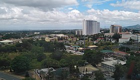
Ing Lakanbalen ning Tagaytay pang3 yang klasing lakanbalen king lalawigan ning Cavite, Filipinas. Agpang keng 1 Mayu 2020 ning sensus, atin yang populasyun a 85,330 a katau kareng 22,399 a pamimalemale.
Deng Barangay
[mag-edit | alilan ya ing pikuwanan]Ing Tagaytay Lakanbalen atin yang 34 a barangay.
- Asisan
- Bagong Tubig
- Dapdap West
- Francisco (San Francisco)
- Guinhawa South
- Iruhin West
- Calabuso
- Kaybagal South (Poblacion)
- Mag-Asawang Ilat
- Maharlika West
- Maitim 2nd East
- Mendez Crossing West
- Neogan
- Patutong Malaki South
- Sambong
- San Jose
- Silang Junction South
- Sungay South
- Tolentino West
- Zambal
- Iruhin East
- Kaybagal North
- Maitim 2nd West
- Dapdap East
- Guinhawa North
- Iruhin South
- Kaybagal East
- Maharlika East
- Maitim 2nd Central
- Mendez Crossing East
- Patutong Malaki North
- Silang Junction North
- Sungay North
- Tolentino East
Demograpiku
[mag-edit | alilan ya ing pikuwanan]| Taun | Pop. | ±% p.a. |
|---|---|---|
| 1939 | 1,657 | — |
| 1948 | 5,233 | +13.63% |
| 1960 | 7,203 | +2.70% |
| 1970 | 10,907 | +4.23% |
| 1975 | 13,388 | +4.20% |
| 1980 | 16,322 | +4.04% |
| 1990 | 23,739 | +3.82% |
| 1995 | 29,419 | +4.10% |
| 2000 | 45,287 | +9.69% |
| 2007 | 61,623 | +4.34% |
| 2010 | 62,030 | +0.24% |
| 2015 | 71,181 | +2.66% |
| 2020 | 85,330 | +3.63% |
| Sanggunian: Philippine Statistics Authority[1][2][3][4] | ||
Panibatan
[mag-edit | alilan ya ing pikuwanan]- ↑ Census of Population (2015). "Total Population by Province, City, Municipality and Barangay". Total Population by Province, City, Municipality and Barangay. PSA.
- ↑ Census of Population and Housing (2010). "Total Population by Province, City, Municipality and Barangay". Total Population by Province, City, Municipality and Barangay. NSO.
- ↑ Censuses of Population (1903–2007). "Table 1. Population Enumerated in Various Censuses by Province/Highly Urbanized City: 1903 to 2007". Table 1. Population Enumerated in Various Censuses by Province/Highly Urbanized City: 1903 to 2007. NSO. https://archive.org/download/PhilippinesCensusofPopulationLGUs19032007/Region%204A%20Calabarzon%20Philippines%20Census%20of%20Population%201903%20-%202007.xls.
- ↑ Province of Cavite. Municipality Population Data. Local Water Utilities Administration Research Division. Retrieved on [[Disiembri 17, 2016]].
Suglung Palwal
[mag-edit | alilan ya ing pikuwanan]- PhilAtlas.com
- Philippine Standard Geographic Code
- Local Governance Performance Management System
- Divine Word Seminary
- Philippine Travel: Tagaytay Archived Marsu 15, 2008 at the Wayback Machine
| Trece Martires (kapitolyo de facto), Imus (kapitolyo de jure) | |
| Balen | Alfonso ▪ Amadeo ▪ Carmona ▪ General Emilio Aguinaldo ▪ General Mariano Alvarez ▪ Indang ▪ Kawit ▪ Magallanes ▪ Maragondon ▪ Méndez Núñez ▪ Naic ▪ Noveleta ▪ Rosario ▪ Silang ▪ Tanza ▪ Ternate |
| Lakanbalen | Bacoor ▪ Lakanbalen ning Cavite ▪ Dasmariñas ▪ General Trias ▪ Imus ▪ Tagaytay ▪ Trece Martires |

