Grants:IEG/ShareMap
status: not selected
Individual Engagement Grants |
review grant submissions |
visit IdeaLab submissions |
| eligibility and selection criteria | ||
project:
project contact:
contact@sharemap.org
participants:
grantees:
Jakub Kaniewski
advisors:
Yug
summary:
ShareMap.org is a social tool that allows creation a interactive and static maps on free licenses, using internet datasets like OSM, Natural Earth and other.
engagement target:
English Wikipedia (existing community), Polish Wikipedia (existing community), German Wikipedia (existing community) and all other Wikipedias, Wikimedia Commons, Wikivoyage, Wikiversity
strategic priority:
Improving Quality, Increasing Participation
total amount requested:
21540 USD
2013 round 2


Project idea
[edit]ShareMap.org project was launched 2.5 years ago to create a map creation tool. The project idea is to implement some missing features, find all the errors and fund the infrastructure on which the project can exist. Volunteers that can spread the word on Wikipedia on the program and the project will be gladly welcome. We presume that 70% of the work was already done and that 30% still needs to be done.
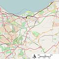
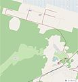
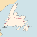
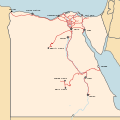
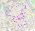
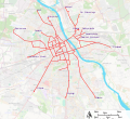
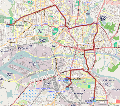
To see examples of maps already created with ShareMap on WikiCommons please follow this link: commons:category:Created_with_ShareMap
To read more about ShareMap project on Wikimedia Commons and WikiVoyage follow these links:
Implemented core features
[edit]- Create collaborative mapping tools - everyone can fix and change the map in the same way as they do on Wikipedia (done)
- Create legal framework for materials published on ShareMap - CC-SA 2.0 modeled after Wikipedia (done)
- Create import tool to import data from existing datasets - currently integrated with Open Street Map (XAPI api) and Natural Earth data (hosted on ShareMap servers) and GPX uploaded by users.
- Create automated mechanisms to export map to SVG and KML format (done)
- Maps should be available for viewing for everyone - on any device with any technology - done
- Allow user to calibrate or map on appropriate license (old, on CC license or public domain)
be
Project goals
[edit]Because ShareMap is an existing project, general project goals are already implemented to some extent. Therefore, the grant money will be spent to improve functionalities and add missing things.
Most important goals
[edit]- Simplify tool as much as possible - ShareMap should be accessible not only to GIS enthusiasts but for everyone interested in map creation, even without mapping experience
- Create desktop version of map authoring application. This application will be working directly with ShareMap portal and Wikimedia Commons, but it will be also possible to use it as standalone application. This will ensure that even in unlike event of closing ShareMap portal users will be still able to create maps.
- Create free, mobile application for map viewing with caching (for off line use) and GPS/GLONASS support. This app will be useful to be tightly linked with WikiVoyage
- Add import export to other formats ([en:Shapefile|Shapefile]] and other supported by GDAL)
- Create workflow to utilize script produced in Grants:IEG/Wikimaps_Atlas in ShareMap production process (for advanced users wishing to have pixel-perfect map)
- Run social program to encourage non technical users to create maps and share their experiences.
Important goals
[edit]- Fix performance problems when working with large datasets - this may include both increasing application performance and some techniques to
- Rework map calibration mechanism to work with poorly projected historical maps
- Add some export format for animated maps that can be used to embed such map to Wikipedia article - currently only animated GIF or Video can be be used. If Wikipedia in near future allow to embedding animated SVG (SMIL) this format will be also considered.
- Add social functions - community leaders that accept checked revisions etc. (modeled after Wikipedia)
- Leverage tagging in more extend to create more map data cloud that hierarchical database
- Improve Google Earth integration (feature often requested by users)
- Introduce OpenID login as the optional way to login (without introducing external dependencies - user is always able to switch to classic authentication method)
- Introduce versioning in ShareMap documentation
- Introduce HTTPS as option on portal
- Finish Wikimedia direct export functionality (using Wikimedia API) - this is currently working but in early beta
- Fix other minor problems on ShareMap portal
Optional goals
[edit]- Create mobile application for map authoring (tablet only)
- Create good license mapping - license everything on CC-SA licenses (already done - improvement and fixes required)
- Create a mapping tool that produces many formats on output - maps created with ShareMap can be viewed with Flash widget, HTML5 widget, in Google Earth plugin, as SVG rendition or as pure KML file, that can be for example be embedded into Wiki (mostly done)
- Add Some integration with TileMill project - there are several scenarios of integration. Both on server and client side, some are more feasible some are more difficult and resource expensive - before implementation feedback from community is crucial
- Study possibility of migration to Apacha Oak (currently in alpha) or MongoDB in case if performance issues will become problem (not a case currently)
Community to do
[edit]- Draw as much attention from community to receive feedback
- Train volunteers to make mapping presentations in history lessons in Polish secondary schools to encourage students to create historical maps that will be included in Wikipedia articles (some program framework and contacts already drafted - task focused on Poland, but can be extended to other countries if some leader will wish to do so)
- Improve ShareMap documentation (MediaWiki format)
- Create video casts for most common ShareMap usage scenarios
- Work closely with Wikipedia groups that are interested in map creation
- Work closely with template Attached KML community
- Work closely with WikiVoyage community
- Organize interactive multiple Q&A sessions (based on demand) for all Wiki editors interested in map making. This session can be performed using Google Hangouts or similar collaboration platform and will include screen sharing and screen box.
Project licensing
[edit]Currently, ShareMap code is not available for public. The entire source code rights are in my hand. When I receive a grant, the entire code will be licensed under the Apache 2.0 license and published on GitHub in the public repository. Future work (for grant money) will be performed on GitHub and will also be licensed using the Apache 2.0.
Part 2: The Project Plan
[edit]Project plan
[edit]Scope:
[edit]Scope and activities
[edit]- Hire a programmer to review and fix code and resolve performance problems
- Hire graphic designers to increase the quality and readability on generated maps (SVG specialist)
- Hire testers or find volunteers to precisely test all aspects of the program. These testers after also will be able to give advices about UI improvements that will make editing process easier.
Tools, technologies, and techniques
[edit]By paradox the most difficult thing in this project will not be adding new features, because most of the features are already available but to make the map editing process so easy and flawless that it attracts as many people as possible. ShareMap does not intent to challenge professional open source tools like Grass GIS or QuantumGIS, but to create a mapping tool that is complementary to these two.
For this project the input and feedback of people on how they would like to create maps and on how they would like the interface to be, will be the most valuable.
Technologies
[edit]ShareMap is mostly technology agnostic it includes many parts in many programming languages - ActionScript 3, JavaScript, Java. As a storage ShareMap uses Apache Jackrabbit very mature content repository comply with Java Content Repository 2.0. Also special code transformation project that converts ActionScript 3 code to JavaScript was created for the project. ShareMap utilize multiple Open Source frameworks: Modest Maps, Leaflet, Apache Batik, Apache FOP, GDAL
Technology stack diagram
[edit]
Comparison with Wikimedia Atlas grant proposal
[edit]This two projects are complementary - ShareMap allows creating maps in social way (collaboration, versioning) and Wiki Atlas goal is to prepare script set to prepare pixel-perfect maps (for more advanced users). Because ShareMap is working on GIS data it can be easily treated as data source for Wiki Atlas scripts.
Both the Wikimaps and Sharemaps grant requests are coordinated. Wikimaps are for short term, stand alone maps, which perfectly fit in current wikipedia cartographers' practices. Sharemap is actually a long term, but more powerful cloud approach, which is the future of in-wikipedia map making. Both initiatives may also eventually merge, thus recycling hundreds high quality SVG maps. Most importantly for now, both initiative need your support. Yug
Budget:
[edit]Total amount requested
[edit]21540 USD
Budget breakdown
[edit]Very general estimation (based on Polish wages)
| Role | Hourly wage | Hours required | Total price |
|---|---|---|---|
| Programmer | 1 hour= 60 pln (=18 USD) | Required man days 90 (6 months timespan) | 12960 USD |
| Designer/UX specialist | 1 hour= 40 pln (= 12 USD) | Required 30 man days (6 months timespan) | 2880 USD |
| Tester | 1 hour= 25 pln (= 7.5 USD) | Required 50 man days | up to 3000 USD |
| Travels to key meetings | 1 travel = 3000 pln ( = 900 USD) | 3 travels | 2700 USD |
| 21540 USD |
This budget will be subject of taxation according to Polish law at this fact was used in this calculation.
Project roles description:
[edit]- Programmer
- Has to be be fluent in programming languages and Open Source technologies used in ShareMap ecosystem (Action Script 3, JavaScript, Java EE, HTML5, Apache Flex)
- Has to feel well with Open Source frameworks used within ShareMap ecosystem (Modest Maps, Leaflet, Apache Batik, Apache Jackrabbit and other) and GDAL.
- Has to know how to use MediaWiki API in efficient and secure way
- Has to work tightly with UX specialist to implement his ideas if they are possible from technical point of view
- Has to work tightly with tester with fixing bugs in multiple environments
- Designer/UX specialist
- Should not be directly involved in any programming - designer has to be an expert in creating application sketchs.
- Designer will be also responsible to create map styling policies after getting touch with community.
- Has to find balance between interface (UX) easiness and effectiveness (ie. if it is worth to create some field directly at window side panel or maybe it is better to created dedicated dialog). The goal of the project is not to create most powerful tool, rather to create tool that can be used by very groups of users.
- Has to design interaction patterns
- Hired testers
- Has test every feature of product in multiple browser and multiple OS to find any bugs and not expected behaviors.
- Has to create and improve user documentation (MediaWiki format)
- Has to create recorded screen casts of several map creation scenarios
- Will lead school education program in Polish secondary schools working tightly with history and geography teachers (other countries can also be included)
Volunteer participation:
[edit]| Volunteer background | Activity type |
|---|---|
| GIS expert | Give suggestions how to incorporate sophisticated GIS workflows to project to make the accessible for users with more basic knowledge |
| Wikipedia editors without map crating background | Very valuable participants that can report what in application is difficult and not straightforward |
| Wikipedia portals administrators and participant | Can give feedback what features can be potentially usable within they portal ie. at portal WikiProject Trains users can signalize that they would like to have ability to directly import dismantled train routes from OpenStreetMap (just example - feature implemented) |
| Wikimedia template and widget contributors | They can report how existing widget integration is working (ie. automatic export to Attached_KML template). ShareMap team members can ask them about possibility of integration new features in Wikimedia widges to use in more extend free CC-SA data directly within wikipedia pages (ie. widget to display maps directly in Wikipedia mobile view) |
| WikiVoyage community leader | Contact is crucial to provide solid tool set for WikiVoyage contributors (not only map experts - all contributors). For example WikiVoyage users can report that they would like to have tool to create POI list directly from ShareMap map (just example - feature already implemented) |
| History/Geography Teachers | Give suggestions what is needed to make ShareMap more friendly tool for team work in their classes. This is especially related with old map tracing tool set. |
Intended impact:
[edit]Target audience
[edit]- Wikipedia project readers
- WikiVoyage project readers (I think that good mapping framework with static/interactive functionality will be crucial for project success)
- Wikipedia project editors (some communities already established on EN, PL and DE Wikipedia - community leaders on other language versions are warmly welcome)
- Other Wikipedia project editors and readers that needs mapping in their day by day work (ie. Wikiversity)
Fit with strategy
[edit]- To improve quality - to provide maps to as many articles as possible. Static maps (that can be used in printed version) as well as interactive maps (where user is able to freely navigate)
- To encourage Wikipedia editors who don't have much experience with GIS to create maps for their articles in an easy way.
- To boost WikiVoyage project and make article interesting for people who were never attracted by Wikimedia projects
Sustainability
[edit]The project already exists for 2.5 years without any external support and without including ADS on its pages (this was several times considered by leaders but was rejected at current project stage). Project hosting is provided by a generous Polish company based in Warsaw. The forum available on ShareMap has active users - ShareMap users forum.
Some ShareMap statistics:
- 400 registered users
- 5703 maps on CC-SA 2.0 license
- 210 daily unique visitors
Measures of success
[edit]Measures of success (accountable)
[edit]- Simplify task - simplification marked as required in user poll will be implemented and after fixes feedback from testers will be published
- Mobile application - application for Android and iOS platform will be available (APK format).
- GIS import - At least SHP and KML import will be introduced.
- Pretty map integration - there will be complete tutorial on Wikipedia how to use ShareMap with pretty map scripts.
- Standalone application - standalone application running in offline mode (without connection with ShareMap portal) will be published for Windows and Mac OS X
- Social program - 15 complicated thematic maps will be created by members of social program (secondary school students probally)
- WikiVoyage - 10 maps with ShareMap will be added to WikiVoyage by it contributors. Tutorial for WV users will be written
- Wikimedia commons - 50 maps for Wikimedia Commons will be created by not-members of ShareMap team
Measures of success (Wikimedia scope)
[edit]- Increase the amount of maps on Wikimedia created by users of ShareMap. This can partially be measured by counting the number of maps that have the Category 'Created with ShareMap' added to them on Wikimedia Commons.
- A set of maps created by students encouraged by lessons to participate in the project.
- Boost multiple initiatives ie. Template:Attached_KML - this can be easily counted by counting pages that uses this template with KML generated with ShareMap (information available in KML metadata - take a look [1])
- Increase the number of maps on Wikivoyage that are available in two forms - interactive ant static. This can be easily counted using some queries on WikiVoyage.
Measures of success (Creative Commons ecosystem scope)
[edit]- Increase the number of page visits on ShareMap page - increase CC license awareness
- Increase ShareMap visibility in Google Search (with clearly visible comment that maps made with ShareMap are on free license) - measurable using Google Analitics
- Increase the number of pages which reuse CC-SA - measurable using Google Analitics (CC-SA license requires putting link to original behind used material)
Participant(s)
[edit]I am a Java and an Adobe Flex programmer with 10 years experience. I created ShareMap from scratch to fit some requirements of me and my colleagues with map creation. The project was mostly driven by requirement, and it implements some features that are not available in other mapping tools or requires a deep knowledge of other tools (OSM import, raster map calibration etc.)
User Yug from the Wikipedia mapping community was a reviewer and a great assistance in the project development and the project presentation within the Wikipedia community.
Part 3: Community Discussion
[edit]Discussion
[edit]Community Notification:
[edit]- w:en:Template_talk:Attached_KML
- w:en:Wikipedia_talk:WikiProject_Maps
- wikivoyage:en:Wikivoyage_talk:Dynamic_maps_Expedition
- commons:Commons_talk:Graphic_Lab/Map_workshop
- w:en:Wikipedia_talk:Graphics_Lab/Map_workshop
- w:de:Wikipedia Diskussion:Kartenwerkstatt#Sharemap
- w:en:Wikipedia_talk:WikiProject_Trains#ShareMap - Wikimedia grant - community feedback needed
Endorsements:
[edit]Do you think this project should be selected for an Individual Engagement Grant? Please add your name and rationale for endorsing this project in the list below. Other feedback, questions or concerns from community members are also highly valued, but please post them on the talk page of this proposal.
- Sharemap can be a very useful tool for Wikipedians. It is far from a finished product. Therefore it is my opinion that the grant should be given. For more information: see my comments on the discussion page. Wereldburger758 (talk) 11:43, 11 October 2013 (UTC)
- I would like to see this not only on PL Wikipedia, but also DE and EN. Even wrote a small paragraph at w:de:Wikipedia:Kartenwerkstatt/Hilfe/Programme#ShareMap some time ago, but I think this project deserves more attention by the WP mapping community. Matthias (talk) 15:59, 11 October 2013 (UTC)
- ShareMap and Jakub are at the forehead of how Wikipedia should be drawing, storing, and sharing maps in the future. A such cloud, centralized, GIS platform for map making is known from Wikipedia cartographers to be something we simply have to get, inevitably, so geolocalised data can stay geolocalised, and translations focus on labels only while background stop to be duplicated. In the past 2 years, Jakub & Co created a low cost open alternative to Google mapmaking technologies. They also have been from the start willing to be contribute under open licence, as well as willing to design tools and styles following Wikipedia best map making practices, as designed by the Wikipedia Map Worshops (where I'am heavily involved). What they achieved without founding is impressive. Yet, ShareMap is currently rather a groundbreaking demo than an end product. Tools, usability, processes, styles, and most importantly integration within the Wikimedia ecosystem could and should be improved. An IEG grant would is need to support -financially & in recognition- a push forward. Doing so, it will greatly lower the technical skills needed by volunteer cartographers to record, design, store and share geographic phenomenons illustrating Wikipedia's articles. Yug (talk) 15:20, 13 October 2013 (UTC)
- Sharemap.Org should be given a grant as they has been very helpful for a municipal governmental project about transportation bus routes. Sharemap.Org is the only online tool we found online as freely available to draw those routes in the open source and share them with the public. With funding they can develop a more free, expanded and precise tool for all to use. We have actually more than 10 routes published and hoping to add near 40. Caguas PR Public Bus Routes Project
- Sharemap is the only free alternative to proprietary online mapping services, as well as it is much simpler in use when compared to desktop mapping software. It also has a decent set of exporting tools, which allows to use created content in print. There are numerous ways for this project to benefit from funding. We have used Sharemap to show geographical origins of samples in our population genetics study. Center "Bioengineering" of Russian Academy of Sciences
- I agree with Yug about ShareMap being a necessary online GIS platform for open license usage, and there needs to be an easy way to make illustrative maps from the burgeoning OSM data. ShareMap have been very responsive to my comments at Wikivoyage, implementing a feature to export pinned POIs to specific Wikivoyage templates, even making a video tutorial for it. Wikivoyage needs quick, up-to-date maps, which takes a long time to do even for experienced users. With extra funding, they can further push on with improvements to interface and integration. -- torty3 (talk) 11:34, 22 October 2013 (UTC)
- Sounds very good for me to help the community to create maps colaborative. We need automatic generated maps by using OpenStreetmap and WIWOSM in WikiMiniAtlas or OSM-Gadget, but we need also for a lot of articles maps generated by hand. These maps should easily to update some years later from somebody else, this is a important feature in the existing workflow where people work with local software. --Kolossos (talk) 17:38, 23 October 2013 (UTC)
- This is an interesting development in the direction of map generation tools. It is another important building block in Wikimedia becoming more spatially expressed. --Susannaanas (talk) 10:38, 24 October 2013 (UTC)
- A very good project that we need to fund. --Tobias1984 (talk) 10:57, 31 October 2013 (UTC)
- Seems great! Ayack (talk) 17:36, 12 November 2013 (UTC)
- Endorsed! Great Project!! --Thomascornyn (talk) 17:04, 10 December 2013 (UTC)


