James Bonsall
I’m an archaeological geophysicist and I work in both the academic and private commercial sectors. I have specialisms in the use of legacy data; 4D time-lapse assessments; the application of electromagnetic induction for the assessment of archaeological sites within challenging environments and variable geological backgrounds; induced polarisation; upland archaeology; conflict archaeology and archaeological deposits threatened by coastal erosion. Recently I’ve been carrying out archaeological research in to the Irish Civil War.
I developed an interest in archaeological geophysics during my BA (King Alfred’s College, 2000) and specialised in the world of geophysics with my MSc in Archaeological Prospection (University of Bradford, 2001). I worked for a small number of private sector archaeological and geophysical companies in the UK before moving to Ireland in 2002.
I was the co-owner and director of Earthsound Archaeological Geophysics (2002-2019), the largest private sector company in Ireland dedicated to the investigation of archaeological remains using geophysical techniques. Although primarily a commercial organization (surveying a wide range of sites in relation to planning applications, including 73 linear corridor infrastructure projects), Earthsound maintained a high academic profile with a healthy publication record, as well being an Industrial Partner in PhD research and partner for a variety of academic research and community archaeology projects.
Since 2008 I have acted as a consultant to the Serious Crime Review Team (a cold case investigation unit) of An Garda Siochána and regularly provide them with forensic geophysical surveys.
Between 2010-2014, I held a National Roads Authority Fellowship and completed my PhD “A reappraisal of archaeological geophysical surveys on Irish road corridors 2001-2010” (University of Bradford, 2014), which resulted in a number of peer-reviewed publications and a procedural guidance document for NRA (now TII, Transport Infrastructure Ireland) staff on how to commission and procure archaeological geophysical surveys on infrastructure projects.
I lectured in the Department of Environmental Sciences, Institute of Technology Sligo, Ireland, where I was responsible for delivering 5 modules in Applied Archaeology at Level 6 (Higher Certificate), Level 7 (BSc degree) and Level 8 (BSc Honours degree), and supervising postgraduate research. I taught modules in both practical and theoretical Archaeological Geophysics, GIS and Geoarchaeology. I was a member of the Centre for Environmental Research Innovation and Sustainability (CERIS) research cluster at IT Sligo. I successfully supervised a PhD candidate assessing Napoleonic-era Signal Defensible Guardhouses in Connacht and Ulster.
I convened the first International Weather Beaten Archaeology Conference (2015) and the 13th International Conference on Archaeological Prospection (2019) at IT Sligo.
I’m currently writing on:
The mapping of palaeolandscapes beneath the Irish Sea via seismic and borehole data
Sligo’s Noble Six, Civil War IRA Soldiers killed by the National Army in 1922
Tormore Cave, a 1922 Civil War IRA Hideout
Forensic survey of Sligo’s cholera field
I have over 20 years of geophysical experience working on archaeological sites in Ireland and Northern Ireland as well as Britain, Italy and Norway, across all archaeological periods, from Palaeolithic deposits in Ireland and the U.K., Mesolithic sites at Larne, Neolithic henge monuments at Stonehenge, proto-Roman settlement at Civitalba, boathouses at the Roman harbour of Portus, Hiberno-Scandinavian longphort at Waterford, Viking settlements at Avaldsnes and Stiklestad, the Black Pig’s Dyke, conflict sites of Vinegar Hill, Cheriton, Kinsale, Sligo and Stiklestad and the garden archaeology of Castle Coole to Second World War air raid shelters in Ireland and Britain.
My published work tends to reflect my personal research interests in archaeological geophysics, the use of novel techniques and the assessment of legacy data as well as selected outputs from 17 years of work in the private sector. My grey literature outputs currently account for more than 200 archaeological geophysical reports mostly derived from planning applications and EIAs, as well as research and community archaeology projects. I have published peer-reviewed articles in Archaeologia Polona; Archaeological Prospection; the Journal of Conflict Archaeology; the Journal of Irish Archaeology; the Journal of Island and Coastal Archaeology, Near Surface Geophysics, Oxford Journal of Archaeology, and I have written chapters for several peer-reviewed books and monographs as well as extended abstracts/proceedings from numerous international conferences. In 2019 I published my first book, New Global Perspectives on Archaeological Prospection. My second book, The Six – The Lives and Memorialisation of Sligo’s Noble Six, was published in 2022.
less
Related Authors
Sam Moore
Institute of Technology, Sligo
Aaron Ó Maonaigh
St Patrick's College Dublin City University
John M. Regan
University of Dundee
Ruairí Ó Baoill
Queen's University Belfast
fiona beglane
Atlantic Technological University
Claire M Guerin
University College Cork
Patrick Witt
University of Missouri Columbia
Marnie Hay
Dublin City University
InterestsView All (36)


Uploads
Papers by James Bonsall
At present more than 1,600 toghers (wooden trackways) or parts of toghers are mapped in the Irish SMR, however the wet and uneven ground surface of the Irish bogs have long posed a challenge to the prospection of these landscapes using archaeological geophysical methods. The function and morphology of trackways also impede meaningful assessments. While many trackways can be used as access routes between drier, higher lands, others terminate within a bog for no apparent reason. In other cases, isolated platforms exist, the function of which have not been determined. It is therefore difficult to anticipate, model or predict where a wooden trackway may be located within a bog, as linking archaeological or natural dryland sites is not necessarily their function. Some geophysical techniques are appropriate to the study of palaeoenvironments and wooden structures. Electromagnetic and induced polarisation methods have been applied at Edercloon, Co. Longford, a large wooden trackway complex, in an attempt to map some of the known trackways beyond an excavation cutting. Many of the Edercloon trackways were shown to abut and cross over and beneath each other, increasing the complexity of identifying specific or groups of specific features using geophysical methods. A semi3D inversion of induced polarisation data demonstrated that distinctive trackwayderived anomalies could be clearly traced, mapping at least three known Late Bronze Age and Iron Age trackways which continued across the survey area beyond the excavation, increasing the known length of one of the tracks by 19m. The use of induced polarisation and its application to wider areas of study is discussed in light of these results.
graves often depends on a site-by-site basis. The failure of geophysical techniques for detecting
unmarked graves may be due to a poor understanding of the nature of the graves themselves, the context of which they lie in, and temporal changes to the burial state. Given the unpredictability of these variables, it is surprising that grave prospection is often undertaken using only a single method. This paper presents a multi-methodological survey strategy for detecting unmarked burials and utilises an analytical approach for visualising and evaluating the survey results. Our results illustrate the complexity of characterising burials using ground-based remote-sensing techniques and substantiates the assertion that single techniques by themselves are unlikely to provide definitive statements on grave location. At High Royds Cemetery, applying an analytical integration strategy improved our understanding of the separate methods’ results, both independently and in relation to one another. A more thorough understanding of the commonalities and differences between the disparate datasets, has led to a more holistic, and more confident, interpretation of the site.
Recent winter storms had a considerable impact on vulnerable archaeological sites in Ireland. Stone forts fell into the sea. Castles crumbled to the ground. Shipwrecks, middens, timber trackways and ancient drowned forests were revealed for the first time in centuries. Heritage venues were flooded and a large number of archaeological sites were lost entirely. Ireland is coming to terms with the almost annual frequency of severe storm events. The National Monuments Service - responding to notifications from members of the public - sends teams of experts to further investigate storm-related discoveries. Irish legislation requires intrusive fieldwork to be carried out only by archaeologists working under a pre-approved licence, which limits the contribution of citizen scientists to discovery and non-destructive recording. Despite the need for a coherent coastal monitoring strategy, funding citizen science schemes - even for basic tuition in recording methods - is still a challenge. Archaeological and environmental staff and students at the Institute of Technology Sligo - acting as local coastal rangers - have discovered previously unrecorded burnt mounds of stone, middens, peat shelves and trackways on eroding beaches in Co. Sligo during the winter of 2014-15.
Our coastal rangers are engaging with local stakeholders that already have a significant presence at vulnerable erosion sites; Scouting, anti-litter and bird watching groups. Tuition in archaeological recording techniques, including high-resolution photography for later use in photogrammetry, will initiate 'Monitoring the Archaeology of Sligo's Coastline' (MASC), a pilot study for rangers to act as ‘first responders’ capable of making an informed decision to notify relevant government departments.
The Kilcashel Landscape Project has applied the methods and techniques of landscape archaeology to comprehensively assess the townland of Kilcashel, Kilmovee, Co. Mayo. The project has collated historical & archaeological data from Kilcashel and combined this with new data gathered non-intrusively by field-walking, topographic mapping, geophysics, standing building recording and the creation of an Oral History Database.
Geophysics has been used to assess a large Stone Fort, for which local folklore suggests is connected via a 620m long tunnel to another fort at Cashelgal.
A key objective of the NRA is to ensure that the vast quantity of archaeological information generated by road scheme activity feeds back, not only into the decision-making and project-planning process, but also that this knowledge is disseminated and is transparently accountable to the Irish public, who have funded much of the work.
The major outputs of the assessment include a reappraisal of the geophysical data in light of subsequent excavations, a guidance document advising the NRA on the best practices for future geophysical assessments and a publicly accessible database of the geophysical reports (https://www.field2archive.org/nra/), made available by the NRA. The reappraisal of geophysical data has facilitated a technical review of the success or otherwise of detailed magnetometry and scanning surveys across a range of geologies and soils for which quantitative data is now available.
The research has served to place the NRA in a unique position with respect to development and application of new archaeological geophysical investigation technologies and techniques. This has direct benefits for the efficiency and suitability of the NRA's work on road schemes. The assessment of geophysical survey 'success' will lead to a sustainable future for geophysical survey on linear projects in Ireland, while some of the conclusions to the research are likely to have ramifications beyond the Irish road corridors from which the data derives."
James Bonsall, Dr. Chris Gaffney and Prof. Ian Armit at the University of Bradford were commissioned to review archaeological geophysical surveys on NRA road schemes from 2001 to 2010 as part of an NRA Fellowship Programme. One of the key deliverables of the research Fellowship was an on‐line database from which the geophysical reports could be viewed. The NRA Archaeological Geophysical Survey Database has been designed by James Bonsall and Thomas Sparrow to meet this need and can be currently accessed at https://www.field2archive.org/nra/ ."
The annual winter storms now regularly require rescue work by governments and archaeologists, allow chance finds by members of the public and have necessitated the creation of citizen science schemes to report vulnerable / newly discovered sites.
The Weather Beaten Archaeology Conference is the first of its kind and will establish a forum for the exchange of experiences of extreme weather events and their impact on archaeological sites.
Who is coming?
Our speakers include Policy Makers, Environmental Geoarchaeologists, Climatologists, Archaeologists, Historians and Social Media Commentators.
Although primarily concerned with experiences from Ireland, Britain, Sweden and France, the conference will extend a warm welcome to diverse experiences from around the world.
The main themes of the Conference include:
The Winter Storms of 2013-14 – Lost Sites and New Discoveries
Predictive Climatology: Freak Events or Frequent Events?
Vulnerable Monuments at Risk of Weather
Mitigation: Monument Monitoring & Protection Methods
Revelation of Ancient Drowned Forests
Government and Heritage Organisations – Inundated with Data
The Public Response & Citizen Scientists
The main themes of the Conference include:
● The Winter Storms of 2013-14 - Lost Sites and New Discoveries
● Predictive Climatology: Freak Events or Frequent Events?
● Vulnerable Monuments at Risk of Weather
● Mitigation: Monument Protection and Engineering Solutions
● Revelation of Ancient Drowned Forests
● Second World War Coastal Defences
● Government and Heritage Organisations - Inundated with Data
● The Public Response & Citizen Scientists
Coastal archaeological sites have always been vulnerable to erosion. In recent years this vulnerability has become a contentious issue when a variety of archaeological sites across Northern Europe were impacted by the winter storms of 2013-14. Stone forts fell into the sea. Castles crumbled to the ground. Shipwrecks, middens, timber trackways and ancient drowned forests were revealed for the first time in centuries. Heritage venues were flooded and a large number of archaeological sites were washed away entirely. The annual winter storms now regularly require rescue work by governments and archaeologists, allow chance finds by members of the public and have necessitated the creation of citizen science schemes to report vulnerable / newly discovered sites. The Weather Beaten Archaeology Conference is the first of its kind and will establish a forum for the exchange of experiences of extreme weather events and their impact on archaeological sites.
Summary report on research 2016-2017
Europe's Lost Frontiers is a 5 year research project (2015 - 2020), funded by the European Research Council, and brings together experts from the fields of archaeology, geophysics, molecular biology and computer simulation to explore these lost landscapes. The project aims to study how the communities of the great plains reacted to climate change and the encroaching sea, as well as seeking clues to how these communities responded to the introduction of farming and the decline of hunter-gatherer societies
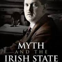
Tormore Cave, high in the mountains of County Sligo, in the northwest of Ireland, was one such dugout. Over 30 Republican men sought refuge there for six weeks in September and October 1922. Like most dugouts, Tormore Cave was never mentioned in historical accounts or documentary sources, but its significance was remembered locally. Archaeological excavations conducted on the centenary of its occupation revealed the extensive modifications that had transformed this natural limestone cave into a habitable military dugout, a crucial refuge for combatants whose comrades had been executed or arrested by Government forces. The historical artefacts and environmental material recovered during the excavations, combined with detailed archaeological surveys and analyses, provide a fascinating insight into the conditions endured by those billeted there. The lives of the men and women directly associated with the cave dugout are explored, including an in-depth study of IRA General Officer Commanding Billy Pilkington – a key figure during the Irish revolutionary period who has, until now, been largely overlooked.
An Irish Civil War Dugout: Tormore Cave, County Sligo adopts a multidisciplinary approach, the first of its kind in an Irish context, combining archaeology, local and military histories, family memories, community recollections, and landscape studies. This ground-breaking study – the first archaeological excavation of a Civil War site in Ireland, facilitates a wider discussion of the role of dugouts in guerrilla warfare. By focussing in detail on one site at a local level, this book provides a unique and valuable contribution to the Irish revolutionary period on a regional and national scale.