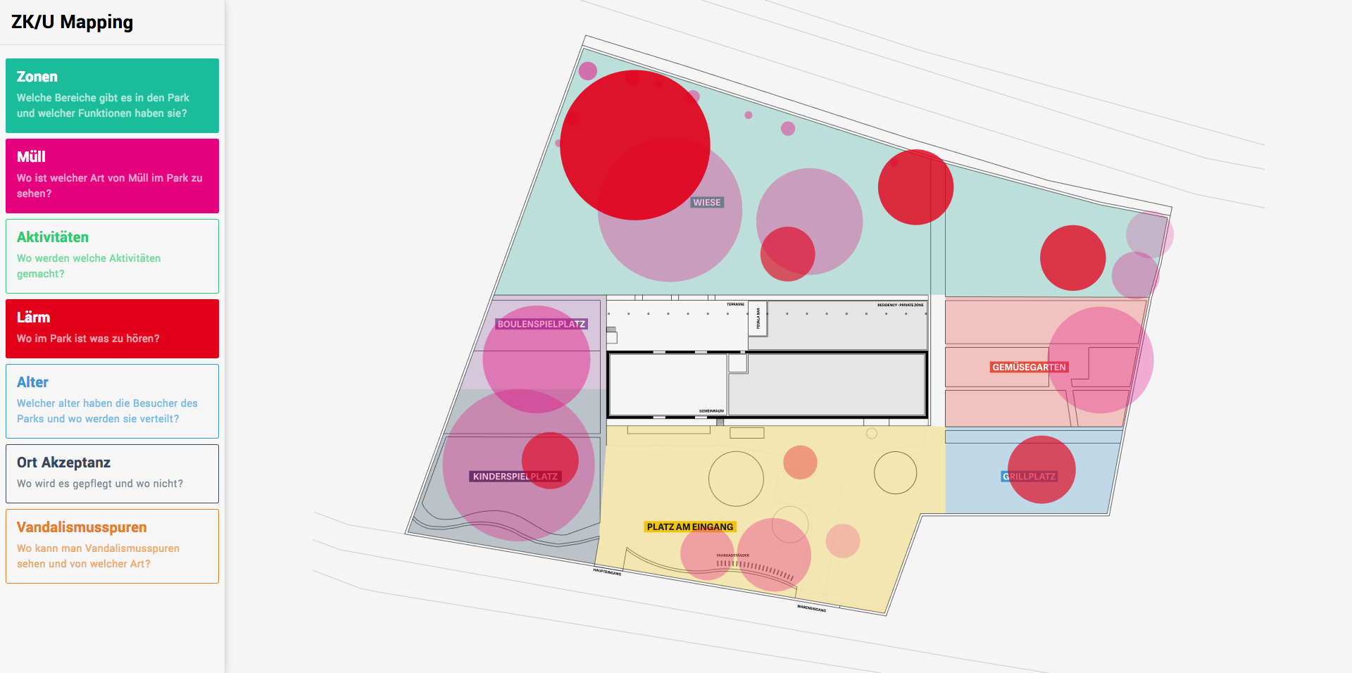
Interactive map of the Moabiter Stadtgarten around the ZK/U (Center for Art and Urbanistic).
On this map, there are multiple layers of dimensions that you can show and hide in order to navigate through the different dimensions investigated on the field, such as sounds, zones, activities, trash repartition, etc.
To run the website clone the repo and navigate into it:
cd zkuMapping/Install the dependencies:
yarn installStart the server and watchers:
yarnpkg run devAnd then open localhost:3000
To deploy, I use now:
yarnpkg run deploy