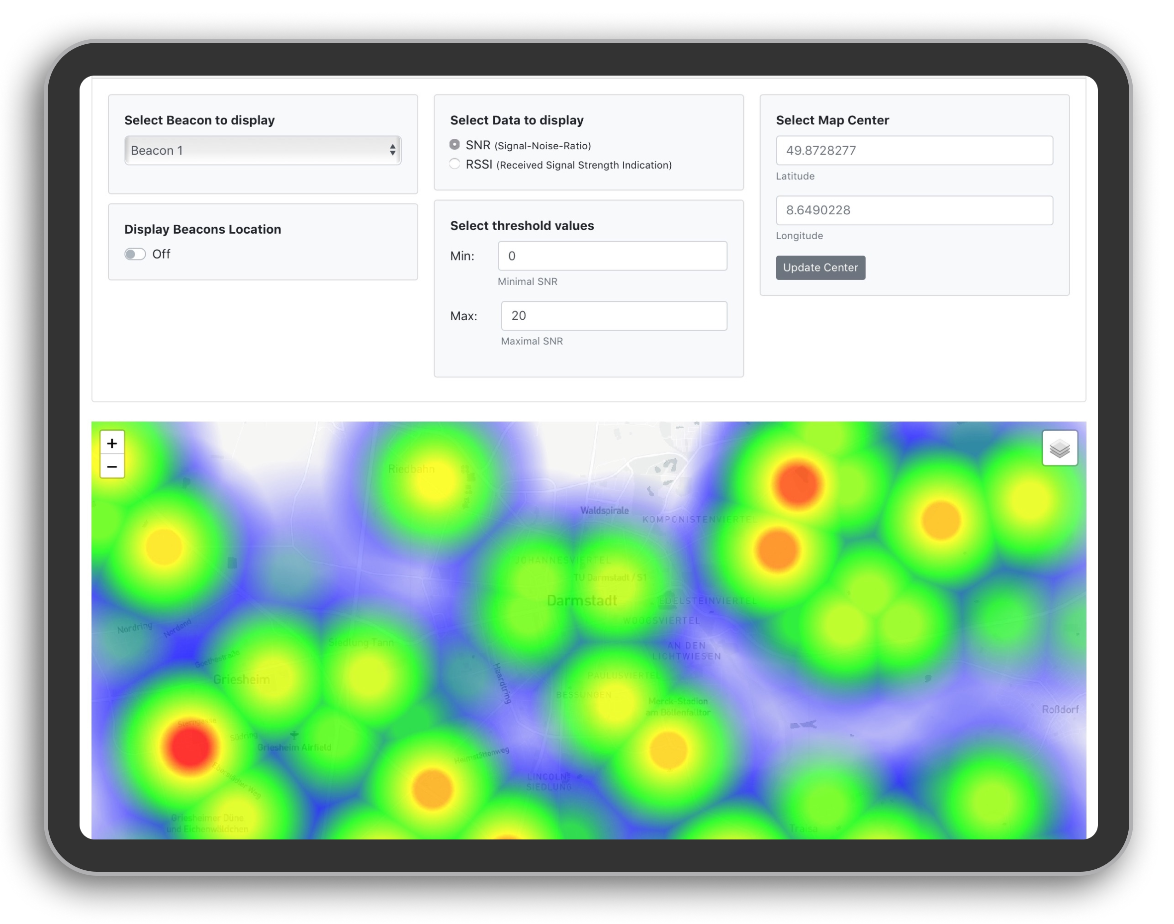
A web application was created to visualize recorded signal quality data. The data is presented as a heat map. A demo of the coverage map web application can be found on index.html and here.
The frontend of the web application consist of two parts:
- On the top you have filter options to choose what data you want to display how on the map.
- On the bottom there is a map view, showing the coverage map chosen in the filter options.
The index.html file contains the frontend for the coverage map web application.
The assets/js/script.js file contains all the functions and code to display the heat map and to make the filter option interactive.
To mock the recorded data, 1000 data points where generated with Mockaroo. The data can be found in assets/data/demo_data.js and is formatted as JSON:
[{
        "beaconID": 6,
        "packetID": 1,
        "latitude": 49.861697,
        "longitude": 8.601973,
        "rssi": -89,
        "snr": 12.82,
        "time": "2020-03-21T20:28:46Z"
    },
    {
        "beaconID": 2,
        "packetID": 5,
        "latitude": 49.897935,
        "longitude": 8.60256,
        "rssi": -37,
        "snr": 9.01,
        "time": "2020-05-08T07:57:33Z"
    },
    ...
]
The location of beacons are stored in assets/data/demo_beacons.js and formatted this way:
[{
    "beaconID": 1,
    "latitude": 49.902525,
    "longitude": 8.564788,
    "description":  "This is the location of a mock beacon."
  },
  ...
]The following dependencies were used for the coverage map generation:
Leaflet was used to display the map on the webpage, it was used because it is open source and highly customizable.
To generate the heat map the leaflet plugin heatmap.js was use. More precicley a fork of heatmap.js by Woracheth. It resolves the issue of the original repository where multiple points at the same position would increase the intensity. In our case we want that multiple points are averaged.
An alternative leaflet-plugin for creating heat maps is Leaflet.heat. This solution was tested but finally not used because it has the unwanted behavior adding up values of multiple points at the same location instead of averaging them.
For the frontend Bootstrap is used. The individual filter options added as bootstrap cards, that are arranged differently, depending the devices screen size.
The coverage map can be improved in different ways:
- Fine tune radius and blur factor and maybe add option to change it manually in the frontend.
- Filters could be added, such as the options to display only data within a given date range, or a selected season.
- For parts of the coverage map with no data about the quality of the received signal, values could be interpolated using heuristics.
- In order to be able to make a good statement about the best position for a base station, one must take into account the individual coverage maps of all beacons. For this it would be beneficial if the signal qualities of all beacons were compiled in a single coverage map.
- Make the web application offline compatible, for use in forests.
