Sentinel-2 is an Earth observation mission from the Copernicus Programme that systematically acquires optical imagery at high spatial resolution (10 m to 60 m) over land and coastal waters. The mission is a constellation with two twin satellites, Sentinel-2A and Sentinel-2B.
-
The mission supports a broad range of services and applications such as agricultural monitoring, emergencies management, land cover classification or water quality.
-
Sentinel-2 has been developed and is being operated by ESA, and the satellites were manufactured by a consortium led by Airbus DS.
-
The aim of land use and land cover classification is to automatically provide labels describing the represented physical land type or how a land area is used (e.g., residential, industrial).
-
EuroSAT dataset consists of 27,000 labeled images with 10 different land use and land cover classes.
-
Sentinel-2A is one satellite in the two-satellite constellation of the identical land monitoring satellites Sentinel-2A and Sentinel-2B. The satellites were successfully launched in June 2015 (Sentinel-2A) and March 2017 (Sentinel-2B).
-
The two-satellite constellation generates a coverage of almost the entire Earth’s land surface about every five days.
To construct an image classification dataset, we performed the following two steps:
-
Satellite Image Acquisition: We gathered satellite images of European cities distributed in over 34 countries.
-
Dataset Creation: Based on the obtained satellite images, we created a dataset of 27,000 georeferenced and labeled image patches. The image patches measure 64x64 pixels and have been manually checked.
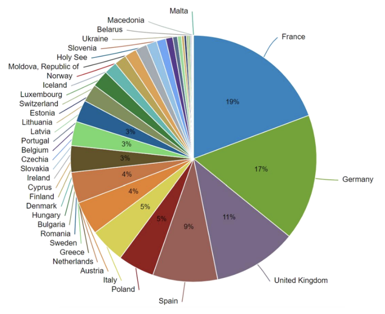
The covered cities are distributed over the 34 Euro-pean countries: Austria, Belarus, Belgium, Bulgaria, Cyprus,Czech Republic (Czechia), Denmark, Estonia, Finland, France,Germany, Greece, Hungary, Iceland, Ireland, Italy / Holy See,Latvia, Lithuania, Luxembourg, Macedonia, Malta, Republicof Moldova, Netherlands, Norway, Poland, Portugal, Romania, Slovakia, Slovenia, Spain, Sweden, Switzerland, Ukraine and United Kingdom.
In order to improve the chance of getting valuable image patches, we selected satellite images with a low cloud level. Besides the possibility to generate a cloud mask, ESA provides a cloud level value for each satellite image allowing to quickly select images with a low percentage of clouds covering theland scene.
We have chosen 10 different and use and land cover classes based on the principle that theyshowed to be visible at the resolution of 10 meters per pixel.
Aplications:
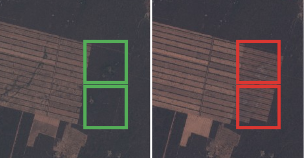
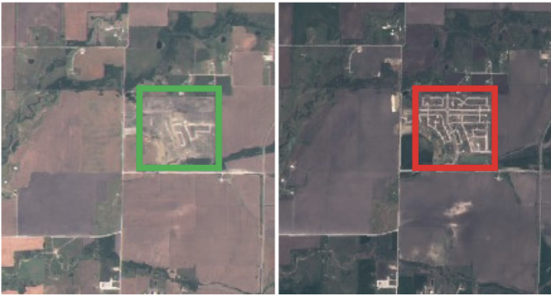
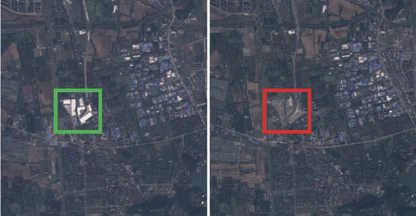
- Land Use and Land Cover Change Detection
- Assistance in Mapping
- Deforestation is a main contributor to climate change, therefore the detection of deforested land isof particular interest (e.g., to notice illegal clearing of forests).

|
| EuroSAT dataset distribution. The georeferenced images are distributed all over Europe. The distribution is influenced by the number of represented cities per country in theEuropean Urban Atlas |
EuroSAT: A Novel Dataset and Deep Learning Benchmark for Land Use and Land Cover Classification. Available from: https://www.researchgate.net/publication/319463676_EuroSAT_A_Novel_Dataset_and_Deep_Learning_Benchmark_for_Land_Use_and_Land_Cover_Classification


