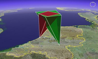
To get a better understanding of the atmospheric volume that is monitored by a (meteor) camera, one may use 3D GIS-software such as Google Earth to interactively explore the field of view of a camera. To do this, we created a PHP-script called "FOV3D". The script generates a 3D semi-transparant polygon representing the field of view of a given camera.
The script produces output in the KML-format, which is an XML-based language for describing geospatial data. KML-files can be imported into GIS-software such as Google Earth, NASA World Wind and ArcGIS. However, the files generated by this script have only been verified to work with Google Earth.
FOV3D was written by Geert Barentsen, the source code was downloaded from this ESA website.
