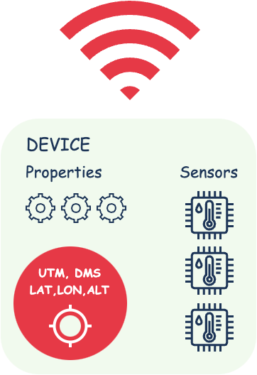
GPS data generator based on predefined routes. Supports GPX and GeoJSON route formats.
This library can be used in testing and debugging applications or devices dependent on GPS/GLONASS/ETC, allowing you to simulate locations for checking their functionality without actual movement.
$ go get github.com/mmadfox/go-gpsgenpackage main
import (
"fmt"
"os"
"os/signal"
"syscall"
"time"
"github.com/google/uuid"
"github.com/mmadfox/go-gpsgen"
)
const (
numTracksPerRoute = 3
numTrackers = 1000
flushInterval = 3 * time.Second
)
func main() {
lon := 37.625616307117696
lat := 55.75350460378772
genOpts := gpsgen.NewOptions()
genOpts.Interval = flushInterval
gen := gpsgen.New(genOpts)
// For network transmission
gen.OnPacket(func(b []byte) {
// udp.send(b)
})
gen.OnError(func(err error) {
fmt.Println("[ERROR]", err)
})
gen.OnNext(func() {
fmt.Println("tracker state changed successfully")
})
// Generate random routes
for i := 0; i < numTrackers; i++ {
tracker := gpsgen.NewTracker()
tracker.SetUserID(uuid.NewString())
route := gpsgen.RandomRoute(lon, lat, numTracksPerRoute, gpsgen.RouteLevelM)
tracker.AddRoute(route)
gen.Attach(tracker)
}
terminate(func() {
gen.Close()
})
gen.Run()
}
func terminate(fn func()) {
sigChan := make(chan os.Signal, 1)
signal.Notify(sigChan,
syscall.SIGHUP,
syscall.SIGINT,
syscall.SIGTERM,
syscall.SIGQUIT)
go func() {
<-sigChan
fn()
}()
}tracker := gpsgen.NewDroneTracker()
route, err := gpsgen.DecodeGeoJSONRoutes(geoJSONBytes)
if err != nil {
panic(err)
}
tracker.AddRoute(route...)
// ...tracker := gpsgen.NewDroneTracker()
route, err := gpsgen.DecodeGPXRoutes(GPXBytes)
if err != nil {
panic(err)
}
tracker.AddRoute(route...)
// ...tracker := gpsgen.NewDroneTracker()
// lon, lat, numTracks, zoomLevel
lon := 28.31261399982
lat := 53.247483804819666
numTracks := 2
route := gpsgen.RandomRoute(lon, lat, numTracks, gpsgen.RouteLevelXL)
tracker.AddRoute(route...)
// ...A sensor provides a flexible and expandable way to represent and work with sensors. It enables the generation of different values for various tasks, making it suitable for diverse applications and use cases, including sensor data collection, modeling, or analysis.
// types.WithSensorStartMode: Generation starts from the minimum value of 1 to 10
// types.WithSensorEndMode:   Generation ends at the minimum value from 10 to 1
// types.WithSensorRandomMode: Data generation follows a Bezier curve from 1 to 10

minValue := 1
maxValue := 10
amplitude := 16 // 4 - 512

s1, err := gpsgen.NewSensor("s1", minValue, maxValue, amplitude, types.WithSensorStartMode|types.WithSensorRandomMode|types.WithSensorEndMode)
if err != nil {
	panic(err)
}

droneTracker.AddSensor(s1)
s2, err := gpsgen.NewSensor("s2", 10, 20, 16, types.WithSensorRandomMode|types.WithSensorEndMode)
if err != nil {
	panic(err)
}
droneTracker.AddSensor(s2)
s3, err := gpsgen.NewSensor("s3", 20, 30, 16, 0)
if err != nil {
	panic(err)
}
droneTracker.AddSensor(s3)
// ...Device:
id
user_id
tick
duration
model
speed
distance
battery (charge, charge_time)
routes (routes)
location (lat, lon, elevation, bearing, lat_dms, lon_dms, utm)
navigator (current_route_index, current_track_index, current_segment_index)
sensors (id, name, val_x, val_y)
description
is_offline
offline_duration
color
time_estimate
Device.Battery:
charge
charge_time
Device.Routes:
routes (Route)
Device.Routes.Route:
id
tracks (Track)
distance
color
props
props_count
Device.Routes.Route.Track:
distance
num_segments
color
props
props_count
Device.Sensor:
id
name
val_x
val_y
Device.Navigator:
current_route_index
current_track_index
current_segment_index
Device.Distance:
distance
current_distance
route_distance
current_route_distance
track_distance
current_track_distance
segment_distance
current_segment_distance
Device.Location:
lat
lon
elevation
bearing
lat_dms (degrees, minutes, seconds, direction)
lon_dms (degrees, minutes, seconds, direction)
utm (central_meridian, easting, northing, long_zone, lat_zone, hemisphere, srid)
Packet:
devices (Device)
timestamp

