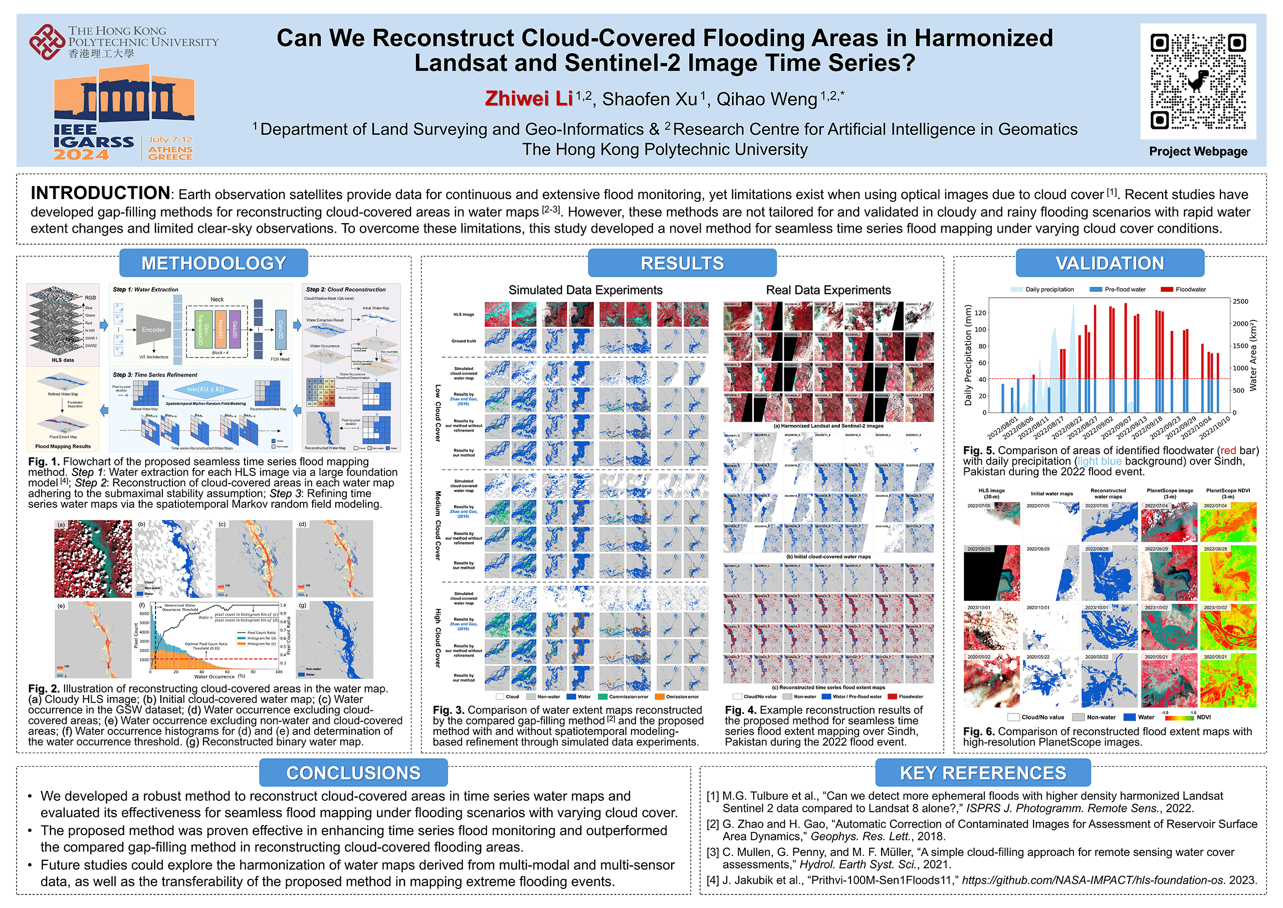
SeamlessFloodMapper: Seamless Flood Mapping Using Harmonized Landsat and Sentinel-2 Image Time Series
Earth observation satellites provide data for continuous and extensive flood monitoring, yet limitations exist when using optical images due to cloud cover. Gap-filling methods have been developed for reconstructing cloud-covered areas in water maps. However, the existing methods are not tailored for and validated in cloudy and rainy flooding scenarios with rapid water extent changes and limited clear-sky observations. To overcome these limitations, we developed a novel method for seamless time series flood mapping under varying cloud cover conditions.
📝Publications:
Zhiwei Li, Shaofen Xu, Qihao Weng, 2024. Can we reconstruct cloud-covered flooding areas in harmonized Landsat and Sentinel-2 image time series?, IEEE International Geoscience and Remote Sensing Symposium (IGARSS). pp. 3686-3688. Athens, Greece. [PDF] [Poster]
Zhiwei Li, Shaofen Xu, Qihao Weng, 2024. Beyond Clouds: Beyond clouds: Seamless flood mapping using Harmonized Landsat and Sentinel-2 time series imagery and water occurrence data. ISPRS Journal of Photogrammetry and Remote Sensing. (In Revision)
💻Code:
Source code for seamless time series flood mapping using harmonized Landsat and Sentinel-2 images is available now. [New]
🗂️Datasets:
Datasets including HLS image time series over the four study sites is available now. [New]