Silberberg (Bodenmais)
Appearance
You can help expand this article with text translated from the corresponding article in German. (June 2010) Click [show] for important translation instructions.
|
| Silberberg | |
|---|---|
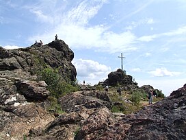
 The twin peaks of Silberberg from west direction | |
| Highest point | |
| Elevation | 955 m (3,133 ft) |
| Geography | |
 | |
| Location | Bavarian Forest, Bavaria, Germany, |
Silberberg is a mountain of Bavarian Forest, Bavaria, Germany.
Gallery
[edit]cable car, toboggan run, ski run
[edit]-
Panoramic map cable railway Silberberg - summer version
-
Panoramic map cable railway Silberberg - winter version
-
A pillar of cable railway Silberberg
-
View from the cable car to the downhill ski area in the summer
-
View to the summer toboggan run
-
View from the little wooded hillside
Summit area of Silberberg
[edit]-
Seen twin peaks of Silberberg from the east.
-
summit cross
-
The twin peaks of Silberberg from west direction
-
The eastern part of the summit massif
-
View from the southeast Silberberg
-
Minerals rich rocks on the steep south-facing slope
Minerals and ores from the Silberberg
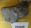
[edit]Some of the 60 minerals of the Silberberg, in the museum room of the visitors' mine
-
argentiferous galena
-
green Orthoclase
External links
[edit]Wikimedia Commons has media related to Silberberg (Bodenmais).
Websites in German language
49°03′26″N 13°07′27″E / 49.05722°N 13.12417°E


