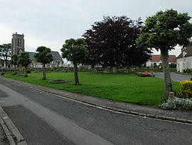
Alincthun
Appearance
Alincthun | |
|---|---|
 The green in front of the church | |
| Coordinates: 50°43′55″N 1°48′07″E / 50.7319°N 1.8019°E | |
| Country | France |
| Region | Hauts-de-France |
| Department | Pas-de-Calais |
| Arrondissement | Boulogne-sur-Mer |
| Canton | Desvres |
| Intercommunality | Desvres-Samer |
| Government | |
| • Mayor (2020–2026) | Jean Picque[1] |
Area 1 | 9.88 km2 (3.81 sq mi) |
| Population (2022)[2] | 296 |
| • Density | 30/km2 (78/sq mi) |
| Time zone | UTC+01:00 (CET) |
| • Summer (DST) | UTC+02:00 (CEST) |
| INSEE/Postal code | 62022 /62142 |
| Elevation | 33–120 m (108–394 ft) (avg. 98 m or 322 ft) |
| 1 French Land Register data, which excludes lakes, ponds, glaciers > 1 km2 (0.386 sq mi or 247 acres) and river estuaries. | |
Alincthun (French pronunciation: [alɛ̃ktœ̃]) is a commune in the Pas-de-Calais department in the Hauts-de-France region of France.
Geography
[edit]A small farming commune comprising 12 hamlets, some 10 miles (16 km) east of Boulogne, at the junction of the D238e2 and the D137 roads. The river Liane flows through the village.
Population
[edit]| Year | Pop. | ±% p.a. |
|---|---|---|
| 1968 | 314 | — |
| 1975 | 309 | −0.23% |
| 1982 | 322 | +0.59% |
| 1990 | 364 | +1.54% |
| 1999 | 343 | −0.66% |
| 2007 | 355 | +0.43% |
| 2012 | 334 | −1.21% |
| 2017 | 330 | −0.24% |
| Source: INSEE[3] | ||
Transport
[edit]The Chemin de fer de Boulogne à Bonningues (CF de BB) opened a station serving Le Wast and Alincthun on 22 April 1900.[4] Passenger services were withdrawn on 31 December 1935.[5] They were reinstated in November 1942.[6] The CF de BB closed in 1948.[7]
Sights
[edit]- The church of St. Denis, dating from the seventeenth century.
- The seventeenth-century Château du Fresnoy.
- Three 17th-century manor houses at La Guilbauderie, Le Fay and Bois-du-Coq.
- A water mill.
See also
[edit]References
[edit]- ^ "Répertoire national des élus: les maires". data.gouv.fr, Plateforme ouverte des données publiques françaises (in French). 2 December 2020.
- ^ (in French). The National Institute of Statistics and Economic Studies. 19 December 2024 https://www.insee.fr/fr/statistiques/8288323?geo=COM-62022.
{{cite web}}: Missing or empty|title=(help) - ^ Population en historique depuis 1968, INSEE
- ^ Farebrother & Farebrother 2008, p. 139.
- ^ Farebrother & Farebrother 2008, p. 239.
- ^ Farebrother & Farebrother 2008, p. 248.
- ^ Farebrother & Farebrother 2008, p. 276.
Sources
[edit]- Farebrother, Martin J B; Farebrother, Joan S (2008). Tortillards of Artois. Usk: The Oakwood Press. ISBN 978-0-85361-554-5.
Wikimedia Commons has media related to Alincthun.


