Doppler radar sends the energy in pulses and listens for any returned signal.
The concept of RAdio Detection and Ranging (Radar)began in the late 1800’s and by World War II, radar was in use by militaries around the world, scanning for incoming airplanes. But the use of radar for weather observations occurred by accident. Analysts noted in periods of heavy weather, the radar would return strange signals. Investigation into this phenomenon resulted in the discovery that these echoes were returns from the precipitation, unmasking a further use for the technology. In 1942, the U.S. Navy donated 25 surplus radars to the NWS (then known as the Weather Bureau), marking the start of a U.S. weather radar system. The technology was refined and in 1959 the NWS began rolling out its first network of radars dedicated to a national warning network.. An updated version, the WSR-74, supplemented and replaced the older radars beginning in 1977. These radars provided similar data but with newer and more reliable components.

NWS Wilmington (OH) WSR-57 Radar image of supercells with hook echoes during 1974 Super Outbreak (courtesy of NCDC)
Around the same time period, researchers began developing a new generation of radars that would incorporate the use of Doppler radar. This allowed forecasters not just to see location and intensity of the precipitation along with basic storm movement, but the movement of the precipitation and winds within the storm itself. After being developed and tested through the 1980s by the NOAA National Severe Storms Laboratory and partners, the first of these Next-Generation Radar systems (NEXRAD) were deployed operationally beginning in 1992.

Locations of NEXRAD Radars in the U.S. and territories
The NEXRAD System provided marked improvements for the NWS. It increased the resolution of the data, allowing forecasters to see storms in much finer detail. Also, the addition of Doppler velocities increased the ability for severe weather detection and warning by allowing forecasters to see wind fields and possible rotation within thunderstorms. The NWS currently operates 159 of these NEXRAD systems and they have undergone several upgrades during 20+ years of operation, including a further increase in resolution, and most recently, an upgrade to dual polarization technology, which provides forecasters a new wealth of information about precipitation including size and shape, better amount estimates, ability to see different types such as rain, snow, and hail, and the ability to differentiate from non-precipitation returns like birds, bugs, and even tornado debris!

Radar reflectivity (left) and radar velocity (right) around time of an EF1 tornado west of Marion, Wisconsin. The insert in the images shows the dual polarization correlation coefficient (CC) product denoting the location of debris produced by the tornado. (Photo Courtesy: National Severe Storms Laboratory)
Even though the NEXRADs have now exceeded their original life-span estimate of 20 years, the radars are currently undergoing a Service Life Extension Program to keep them operating reliably into the 2030’s. Meanwhile, NOAA researchers continue to investigate the next generation of weather radar technology, phased array, as a possible future replacement for NEXRAD.

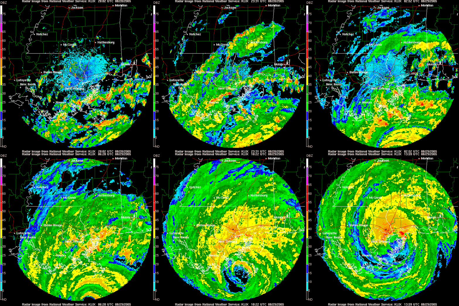
Radar loop from NWS New Orleans, LA during Hurricane Katrina landfall 8/29/2005 (https://www.aoml.noaa.gov/hrd/Storm_pages/katrina2005/radar.html)
For more information on NWS Radar: