SJ9003 : Staffordshire and Worcestershire Canal in Wolverhampton

taken 14 days ago, near to Oxley, Wolverhampton, England
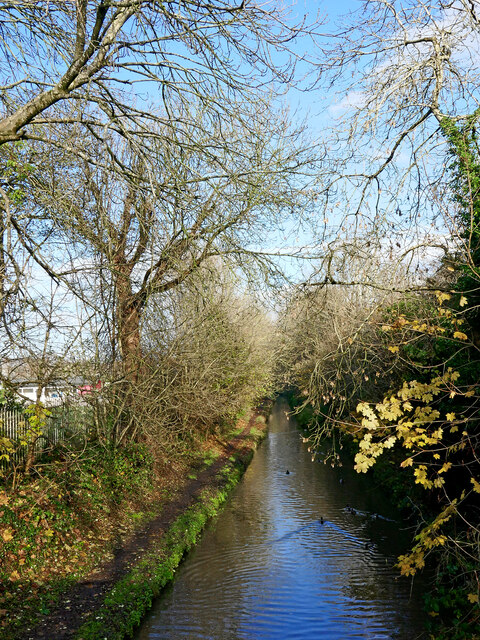
Staffordshire and Worcestershire Canal in Wolverhampton
Looking north-east from Marsh Lane Bridge, near Fordhouses, this is the Staffordshire and Worcestershire Canal. Although it does not appear so in this view, the canal is not wide enough here for boats to pass each other. There are two short passing places, and traffic can be very congested on fine summer weekends.
The canal opened in 1772.

Creative Commons Licence [Some Rights Reserved]   © Copyright Roger D Kidd and licensed for reuse under this Creative Commons Licence.
Geographical Context: Suburb, Urban fringe Canals
1:50,000 Modern Day Landranger(TM) Map © Crown Copyright
+
+
1:50,000 Modern Day Landranger(TM) Map © Crown Copyright
TIP: Click the map for more Large scale mapping
Grid Square
SJ9003, 190 images   (more nearby 🔍)
Photographer
Roger D Kidd   (more nearby)
Date Taken
Wednesday, 27 November, 2024   (more nearby)
Submitted
Thursday, 28 November, 2024
Subject Location
OSGB36: geotagged! SJ 9066 0322 [10m precision]
WGS84: 52:37.5994N 2:8.3650W
Camera Location
OSGB36: geotagged! SJ 9064 0319
View Direction
North-northeast (about 22 degrees)
Clickable map
+
NW N NE
W Go E
SW S SE
Image Type (about): geograph 
This page has been viewed about 4 times
You are not logged in login | register