2024
NH8305 : Kincraig Bridge
taken 5 months ago, near to Kincraig, Highland, Scotland
This is 1 of 7 images, with title Kincraig Bridge in this square

Kincraig Bridge
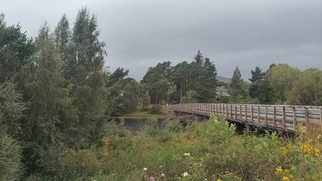
The most striking thing about this bridge is that the uprights and rails forming its sides are made of timber, which is not a common sight on such a long bridge. It is rather like an extended version of something you might expect to find on a remote forestry plantation. The wood use doesn't stop there, however. Amazingly, four of its piers - the ones in the middle - are also made of wood. They have V-shaped pieces of metal vertically attached to them; these are called 'cutwaters' and direct the flowing water around the piers (and, I'd like to think, also help delay rot setting into all that wood).
It was built in the 1870s and is a listed building. Although marked on the map today as 'Kincraig Bridge', it initially went by the name of 'Boat of Insh Bridge'. Contrary to what you might read online, Boat of Insh was never an actual settlement. It merely referred to the location of the ferry crossing and a pub on this side of the water and a railway station on the other also adopted the name. At the time of the bridge's construction Kincraig wasn't there.
Officially, the River Spey flows into a loch (Loch Insh) upstream of here and this bridge crosses the bit at which it is turning into a river again. Unofficially, the River Spey simply has a very large bulge in it around here. I'm assuming this section was chosen for the ferry crossing due to it being the shortest section of water a boat could have been taken across without banging into stones on the riverbed.
