2023

SE8362 : Vessey Pasture Dale

taken 2 years ago, near to Thixendale, North Yorkshire, England

This is 1 of 3 images, with title Vessey Pasture Dale in this square
Vessey Pasture Dale
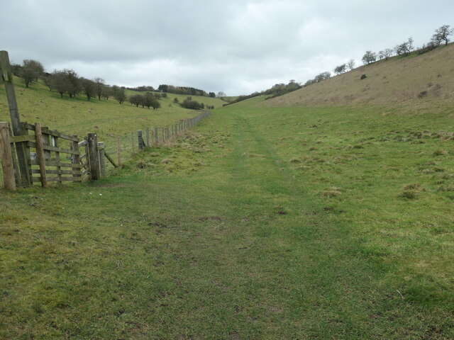
Vessey Pasture Dale
Looking west from the junction of Back Dale. A civil parish boundary runs down the middle of this dale - Birdsall to the right/north, Thixendale to the left/south. The Yorkshire Wolds is the northernmost chalk landscape in Britain. The chalk is 400 metres thick. During the 'ice age' the Wolds were an 'island' surrounded by ice. There would have been heavy ice and snow cover in winter, and then rapid run-off in warmer months, creating the steep sided narrow valleys that we see today. [With thanks to Gordon Hatton for this information].

Creative Commons Licence [Some Rights Reserved]   © Copyright Christine Johnstone and licensed for reuse under this Creative Commons Licence.
Geographical Context: Lowlands Boundary, Barrier Landscape: Chalk Boundary: Civil Parish other tags: Yorkshire Wolds Dale Chalk Dry Valley Click a tag, to view other nearby images.
1:50,000 Modern Day Landranger(TM) Map © Crown Copyright
+
+
1:50,000 Modern Day Landranger(TM) Map © Crown Copyright
TIP: Click the map for more Large scale mapping
Grid Square
SE8362, 65 images   (more nearby 🔍)
Photographer
Christine Johnstone   (more nearby)
Date Taken
Saturday, 18 February, 2023   (more nearby)
Submitted
Tuesday, 28 February, 2023
Subject Location
OSGB36: geotagged! SE 8318 6222 [10m precision]
WGS84: 54:2.9546N 0:43.8620W
Camera Location
OSGB36: geotagged! SE 8333 6223
View Direction
WEST (about 270 degrees)
Clickable map
+
NW N NE
W Go E
SW S SE
Image Type (about): geograph 
This page has been viewed about 18 times
You are not logged in login | register