2014

SY8180 : Landslip at St. Oswald's Bay, near Lulworth, Dorset

taken 10 years ago, near to West Lulworth, Dorset, England
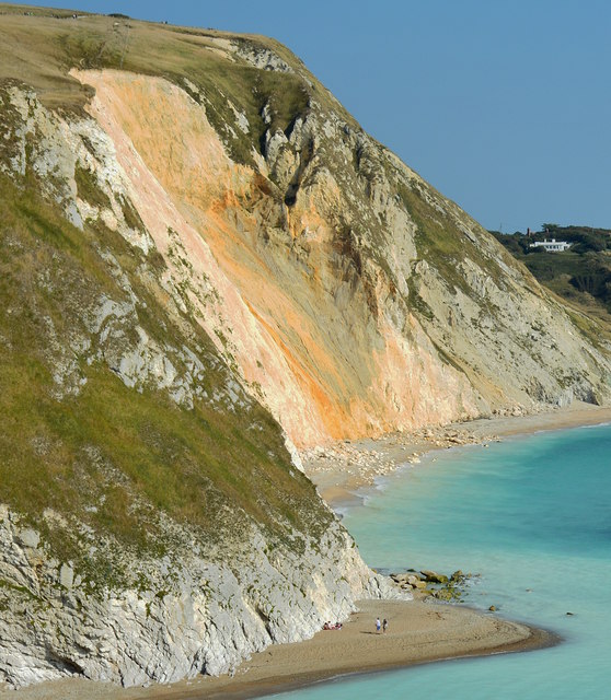
Landslip  at St. Oswald's Bay, near Lulworth, Dorset
Landslip at St. Oswald's Bay, near Lulworth, Dorset
This shows where the cliff collapsed on 29th-30th May 2013, causing the nearby coast path to be closed. 16 months on, fine particles from the chalk rubble are still being washed out to sea, which is more clearly shown in SY8080 : Milky sea, St. Oswald's Bay, near Lulworth, Dorset.

Creative Commons Licence [Some Rights Reserved]   © Copyright Edmund Shaw and licensed for reuse under this Creative Commons Licence.
Geographical Context: Coastal Geological interest Rocks, Scree, Cliffs Primary Subject: Cliff
This photo is linked from: Automatic Clusters: · Near [17] · St Oswald's Bay [17] · Dorset [13] Other Photos: · Milky sea, St. Oswald's Bay, near Lulworth, Dorset · Herring Gull, Man'O'War Bay, Dorset ·
1:50,000 Modern Day Landranger(TM) Map © Crown Copyright
+
+
1:50,000 Modern Day Landranger(TM) Map © Crown Copyright
TIP: Click the map for more Large scale mapping
Grid Square
SY8180, 156 images   (more nearby 🔍)
Photographer
Edmund Shaw   (more nearby)
Date Taken
Tuesday, 16 September, 2014   (more nearby)
Submitted
Saturday, 20 September, 2014
Subject Location
OSGB36: geotagged! SY 8115 8021 [10m precision]
WGS84: 50:37.2772N 2:16.0695W
Camera Location
OSGB36: geotagged! SY 8070 8033
View Direction
East-southeast (about 112 degrees)
Clickable map
+
NW N NE
W Go E
SW S SE
Image classification(about): Supplemental image
This page has been viewed about 129 times
You are not logged in login | register