2013

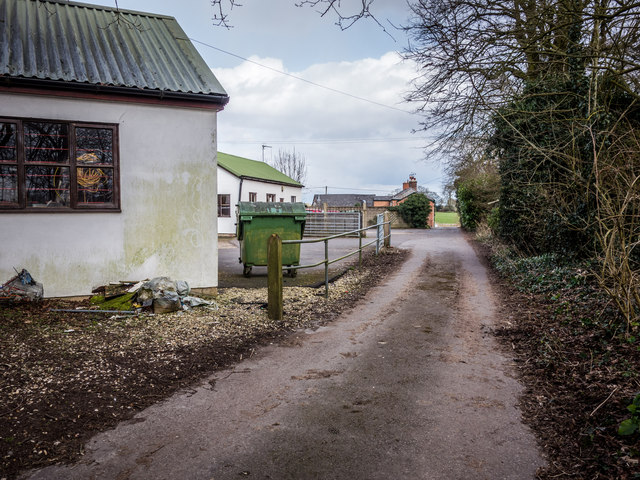
SU1561 : Path past The French Horn

taken 12 years ago, near to Wilcot, Wiltshire, England
Path past The French Horn
The path that leads from Bristow Bridge on the Kennet & Avon Canal to the A345 just north of Pewsey Wharf, Wiltshire.
The 2 white buildings are small industrial units.
The brick building at the far end of the Path just before the road is (back of) The French Horn pub.
Landscape around is rural farmland.

Creative Commons Licence [Some Rights Reserved]   © Copyright Gillie Rhodes and licensed for reuse under this Creative Commons Licence.
Geographical Context: Paths Village, Rural settlement Business, Retail, Services Place: Wiltshire other tags: The French Horn Pub Small Industrial Units Path Wiltshire Pewsey Wharf Click a tag, to view other nearby images.
This photo is linked from: Automatic Clusters: · Bristow Bridge [11] · A345 over the Kennet Avon Canal [6] · French Horn [5] · Path [2] ·
1:50,000 Modern Day Landranger(TM) Map © Crown Copyright
+
+
1:50,000 Modern Day Landranger(TM) Map © Crown Copyright
TIP: Click the map for more Large scale mapping
Grid Square
SU1561, 74 images   (more nearby 🔍)
Photographer
Gillie Rhodes   (more nearby)
Date Taken
Wednesday, 13 March, 2013   (more nearby)
Submitted
Saturday, 16 March, 2013
Subject Location
OSGB36: geotagged! SU 156 611 [100m precision]
WGS84: 51:20.9477N 1:46.6347W
Camera Location
OSGB36: geotagged! SU 155 611
View Direction
EAST (about 90 degrees)
Clickable map
+
NW N NE
W Go E
SW S SE
Image classification(about): Geograph
This page has been viewed about 80 times
You are not logged in login | register