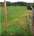
Grid reference SE8823
near to Alkborough, North Lincolnshire, England
Coverage
We have
44 images
in grid square SE8823
Contribute
Explore gridsquare SE8823
Surrounding area
Sample images
Breakdown list
images taken from SE8823 [2]
A sample of 12 photos from 44
for SE8823
- View this square in the Browser >>>

|
Alkborough Flats towards the River Trent
by Glyn Drury
|

|
Farm track off Whitton Road
by JThomas
|

|
Not this way
by David Brown
I think that I am being discouraged to proceed
|

|
Alkborough Flats: aerial 2007
by Chris
A year after the area was first allowed to flood.
Alkborough Flats covers 440 hectares (1090 acres) of low lying land at the confluence of the Trent and Ouse. It is currently the UK’s largest managed realignment site: it was developed as... (more)
|

|
The Public Footpath to Alkborough
by David Wright
This is newly created footpath is part of the development of the Alkborough Flats wetlands area.
|

|
Footpath to Alkborough
by Martin Dawes
On the footpath from Whitton
|

|
The Clough too
by Steve Parker
This sluice used to drain water from Alkborough Flats into the River Humber, facing South. Alkborough Church tower SE8821 : Alkborough Church can be seen on the skyline. (abt 1/5th of the way from the left)
|

|
Alkborough Flats Flood Defences |

|
The ruins of a WWII observation post above Alkborough Flats
by Graham Hogg
Alkborough Flats was used as a bombing range during World War II. This is the remains of one of two such posts that observed the accuracy of the bombing runs.
|

|
Shelter with a view (2)
The remains of a Second World War hut with a bench positioned in front of it means that the view across the Alkborough Flats can be enjoyed in all seasons.
|

|
Alkborough Flats: upstream of the breach
by Chris
Looking back towards the cliff north of Alkborough.
When the wetlands were created, or rather the water was allowed back in, as part of a flood abatement scheme, a breach was created in the sea wall and lined with rocks to prevent erosion.... (more)
|

|
Entrance to a new lake, Alkborough Flats
Not mapped by the OS in 1999. A 170 hectare 'realignment area', created by the Environment Agency. Seen from the barge Sobriety, heading upstream on a rising tide.
|
Explore more images in this square: | View Filtering options | View all 44 images page by page >>> |
|
