Grid reference SD9287
near to Countersett, North Yorkshire, England
Coverage
We have
122 images
in grid square SD9287
Contribute
Explore gridsquare SD9287
Surrounding area
A sample of 12 photos from 122
for SD9287
- View this square in the Browser >>>

|
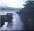
Semer Water outflow
From the bridge looking south-west at the point where the River Bain takes water out of the lake.
|

|
By the mermaid rocks, Semerwater
by Julian Paren
With parking possible this is a popular place to contemplate close to Wensleydale.
|

|
Bridge over the Bain
The bridge is just north of Semer Water.
|

|
Road near Semer Water |

|
View over Raydale towards Semer Water from Billinside Moor
by Tim Heaton
|

|
Footpath leading towards a typical Wensleydale field barn
by Andrew Whale
|

|
Semerwater
by John H Darch
|

|
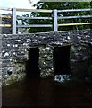
Culvert next to Low Blean Farm
Twin passage stone culvert under the road from Countersett to Stalling Busk at Low Blean. This un-named beck flows into Semer Water.
|

|
Part of Semer water
by Marathon
There are only two lakes in the Yorkshire Dales, Malham Tarn and Semer Water. This is Semer Water in Wensleydale. It was clearly fuller than normal making this look like a mangrove swamp. Legend has it that there is a drowned village under the water.
|

|
Farm Buildings, Low Blean
by Roger Smith
|

|
Benchmark on southwest parapet of Semer Water Bridge
by Luke Shaw
Ordnance Survey documents indicate that in 1954 a cut mark benchmark levelled at 253.612m above Newlyn Datum was present on this parapet. It is still there.
|

|
The Road To Semer Water
Single track road to Semer Water.
|
Explore more images in this square: | View Filtering options | View all 122 images page by page >>> |
|
