Grid reference NT6353
4 km N of Westruther, Scottish Borders, Scotland
Coverage
We have
3 images
in grid square NT6353
Contribute
Explore gridsquare NT6353
Surrounding area
We have
3 images
for NT6353

|
Mid Burn
by Richard Webb
With grazing cattle.
|

|
Quarry, Flass Woodheads
by Richard Webb
|

|
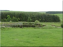
Flight pool
by Richard Webb
The Wedderlie Burn has been dammed to provide an attraction for passing waterfowl.
|
|
