Grid reference NZ0393
3 km from Coldrife, Northumberland, England
Coverage
We have
33 images
in grid square NZ0393
Contribute
Explore gridsquare NZ0393
Surrounding area
Sample images
Breakdown list
images taken from NZ0393 [1]
A sample of 12 photos from 33
for NZ0393
- View this square in the Browser >>>
|
|
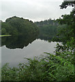
Fontburn Reservoir, western end near Harwood Forest
by Les Hull
|

|
Head of Fontburn Reservoir
by Oliver Dixon
Looking towards the very head of the Reservoir below Newbiggin Farm. Autumn colours at their best.
|

|
Footpath near Fontburn Reservoir
A path runs through a thin belt of trees, mostly conifers, hugging the south side of the reservoir.
|

|
Fontburn Reservoir cup and ring marked stone |

|
More carnage from Storm Arwen
by Leanmeanmo
The fence was suspended some 2m in the air. One year on and there is still a huge backlog of fallen trees to clear.
|

|
The Enigmatic Enclosure
by Mick Garratt
"Sub-rectangular (almost boat-shaped) drystone walled enclosure with no obvious entrance (c.10m x 6.5m; max height 1.5m). Valley floor site. Perhaps a sheepfold located on earlier sheiling?"
‘MNA124752 | National Trust Heritage... (more)
|

|
Footbridge over the Newbiggin Burn
by Russel Wills
This is on the Fontburn Reservoir trail.
The burn soon enters Fontburn Reservoir.
|

|
Cup and ring marked rock at west end of Fontburn Reservoir
The rock, marked on the upper surface, is in the right foreground, under the lower branches of the coniferous trees which line the south side of the reservoir. The view to its left extends over a richly wooded and marshy landscape to Lough... (more)
|

|
Drought at Fontburn Reservoir
by Leanmeanmo
Towards the upper end of the reservoir. The water level has been lower in the past but, some 20 ft down from its maximum, this was close to the lowest point of the summer.
|

|
Fontburn Reservoir (1)
Managed by Northumbrian Water.
An equivalent autumn view: NZ0393 : Head of Fontburn Reservoir.
|

|
Fontburn Reservoir four poster stone circle |

|
Footpath on the south side of the Fontburn Reservoir
by Oliver Dixon
The woodland round the head of the reservoir is designated as a nature reserve. Hence the footpath along the south side of the reservoir runs across the open land adjacent.
|
Explore more images in this square: | View Filtering options | View all 33 images page by page >>> |
|
