Grid reference SE2533
near to New Farnley, Leeds, England
Coverage
We have
275 images
in grid square SE2533
Contribute
Explore gridsquare SE2533
Surrounding area
Sample images
Breakdown list
images taken from SE2533 [11]
A sample of 12 photos from 275
for SE2533
- View this square in the Browser >>>

|
View from cemetery
Armley Hill Top Cemetery is overlooked by four twelve-storey blocks, Poplar Court 1/2 and Poplar Mount 1/2. Built c1962. The contractor was Wimpey.
|

|
Bridge over Henconner Lane
by Chris Heaton
Leeds/Bradford railway line crossing Henconner Lane, Gamble Hill, Leeds.
|

|
Butt Lane, Wortley
Looking towards Gamble Hill.
|

|
Poplar Gate
A small court off Poplar Way, with low-rise housing.
|

|
Poplar Croft - Poplar Way |

|
Greenhill Road, Hill Top, Leeds
by Peter Wood
Looking north-westward from near St Mary's Hospital.
|

|
Tufted ducks and coots, Farnley reservoir
The two groups seemed to be getting along fine.
|
|
|
Panorama of Leeds from Drighlington.
This is a composite of 4 pictures. In the near distance due North is Pitty Close Farm and behind that in the distance is Cookridge tower, on the far side of the Aire Valley. Leeds lies slightly right of centre.
|

|
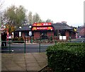
Pub converted to shops, Butt Lane, Bramley
This was The Gamecock and is now Heron Foods with Subway and Greggs tacked on.
|

|
St Mary’s Hospital, Bramley Union Workhouse, Leeds (set of 12 images) |

|
Heights Lane railway bridge
This single-track-width bridge is on what would have been a country lane when it was built to take the lane over the Leeds to Halifax railway in 1854. Now it gives access to a large secondary school, and the amount of traffic on weekdays... (more)
|

|
McDonald's - Butt Lane |
Explore more images in this square: | View Filtering options | View all 275 images page by page >>> |
|
