The Outback Way: Is this the world's emptiest road?
 Westend61/Getty Images
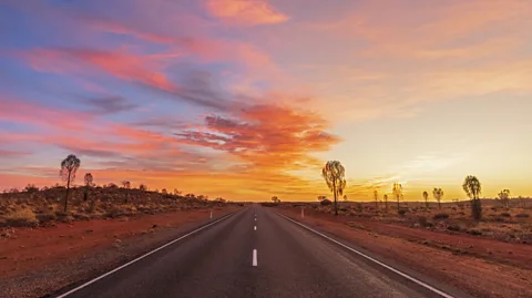
Stretching 2,700km from Laverton in Western Australia to Winton in far-off Queensland, the Outback Way is a great diagonal "shortcut" across the nation that saves weeks of travel.
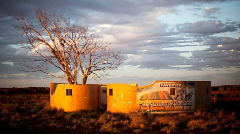
Laverton is the kind of outback town you might expect at the end of an epic desert road trip, not at the start of one. Marooned on the edge of Australia's two largest deserts – the Victoria and the Great Sandy – Laverton felt like the last outpost of frontier civilisation, a 12-hour drive from Perth, five hours from already-remote Kalgoorlie.
Whenever a road train rumbled through town, Laverton rouses into life. Otherwise, it is eerily, gloriously quiet. Tarmac roads disappear beneath the red sand long before they reach the town's outskirts. When the wind picks up, the sand turns to dust and blankets the town with a fine, coppery sheen. After the dust settles, when darkness falls, the stars come out, more stars than seem possible.
Laverton, founded on the traditional lands of the Wongutha and Tjalkanti people, marks the starting point of the Outback Way, also known in Western Australia as the Great Central Road. One of the world's great transcontinental traverses, it was laid out by Len Beadell in the 1950s in what was surely one of the road-building achievements of the time; from 1947 until 1963, Beadell forged more than 6,000km of outback tracks for the Australian government. The marks his bulldozers left behind in the desert sands terrified desert peoples who wondered what great animal had passed this way.
 Zuma Press/Alamy
Standing here nearly 70 years later, there were signs to what lay ahead: the Great Beyond Visitor Centre; the Explorers Hall of Fame; the big-sky views of an endless desert landscape from Windarra Lookout. And before setting out, it was difficult not to contemplate the enormity of the undertaking.
Tracking north-west, connecting one side of Australia to the other, the Outback Way is the most direct route through the heart of the country. Along the 2,700km from Laverton in Western Australia to Winton in far-off Queensland, the Outback Way passes through countless indigenous homelands, skirts isolated national parks and stops in at life-saving outback roadhouses. It ultimately connects Perth with Cairns in a great diagonal shortcut that cuts thousands of kilometres (and weeks of travel) from the paved route that follows the coast for part of the way. As a road trip, it captures the essence of outback travel as it once was.
But, perhaps, all of that may soon be about to change.
At first after I left Laverton, it was difficult to understand why the Outback Way is considered such an epic crossing: the road was paved; the going was easy; and the thrill of departure kept at bay any awareness that ahead lay one of the longest and emptiest roads on the planet.
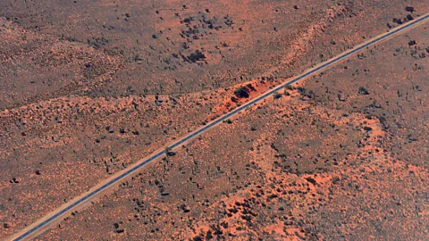
Where the tarmac ended, the jarring presence of road crews, graders and towering eddies of red dust offered a vision of the road's future: one day, perhaps soon, the Outback Way will be sealed along its entire length. Already, only 1,200km remain unsealed and best driven in a 4WD. What it gains in speed and ease of access – after rains, unsealed sections of the road can become impassable – it will surely lose in romance. Here was a road, perhaps even a desert, on the cusp of great and irreversible change.
 gionnixxx/Getty Images
"Can't hold back progress," said Bev Carmichael, with her nearly superfluous "Stop" sign, as a truck with wheels the size of a small family car blocked the way and the smell of hot asphalt caught in my nostrils. "When all this is finished, it'll cut days off the journey. It can't come soon enough for remote indigenous communities out there."
Just who might be making such a journey was a mystery – no other vehicles had passed through Carmichael's checkpoint all day.
Beyond the Tjukayirla Roadhouse 305km after leaving Laverton, the road skirted another of Australia's great deserts, the Gibson. In such lonely surrounds, it was easy to fall prey to the fears of another era, to imagine what it might mean to leave the road behind and strike out into the desert that lay beyond. The desert's name provided a clue. In 1874, a young man named Alfred Gibson was sent to get help by explorer Ernest Giles on the expedition's last remaining camel. Giles survived, but Gibson was never seen again.
Warburton, the first settlement of any size in the 550km from Laverton, felt like a metropolis, and its Tjulyuru Art Centre was filled with canvases of rare beauty by artists from the Ngaanyatjarra people. In town, daytime ennui evaporated with the heat and locals came out to reclaim their streets at dusk. At the Eider Creek Crossing 3km from town, river red gum trees formed what seemed like an honour guard to the deep desert that lay beyond.
Over the days that followed, the road unfurled into the heart of the desert: past the ochre-tinted Rawlinson Range to the north then through the Aboriginal settlement of Warakurna; past Kaltukatjara (Docker River) then through the Petermann Range to the south. This red-rock massif was the final resting place of Harold Lasseter; he died in a cave in the Petermanns in 1931, and with him went any hope of finding the reef of gold he claimed to have found near here.
 ImageBroker/Alamy
The country through which I was driving was beyond remote.
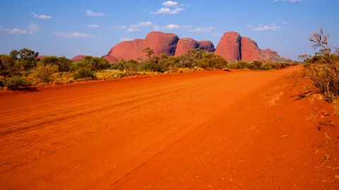
That changed as Kata Tjuta, formerly known as The Olgas, loomed on the eastern horizon. These soulful, domed monoliths at the heart of Anangu country rose hundreds of metres into the air and had the appearance of a giant desert cathedral, nowhere more so than in the haunting Valley of the Winds, an immersive 7.4km loop walk into the heart of the range. Nearby, Uluru was a place of gravitas, spirituality and texture.
Beyond Yulara, the service town for Uluru and Kata Tjuta, the tarmac of the Lasseter Highway was at once a blessing and curse: the desert miles sped past, but with speed came an awareness of what might be missed in the rush of forward momentum. Mt Connor rose from the sands to the south. At the roadside lookout, travellers coming from the east who were yet to see the real Uluru on the horizon, gasped in awe, mistaking it for the more famous landmark. Aboriginal legends say that Ice Men inhabit Mt Connor, emerging on winter nights to sprinkle frost upon the Earth as a symbol of their passing.
The Lasseter Highway ended at the crossroads town of Erldunda, where it met the north-south, Darwin-to-Adelaide Stuart Highway, a prototype, perhaps, for paved transcontinental highways in Australia.
Many empty desert miles north, beyond a rocky defile in the MacDonnell Ranges with its dragons-back ridges and water-filled gorges, lay the large town of Alice Springs, or Mparntwe to its Arrernte traditional owners. Art galleries and bookshops, supermarkets and restaurants, desert wildlife parks and fine sunsets – Alice Springs combined convenience with a true desert sensibility.
 Anthony Ham
But the call of the road was even more powerful, and the journey continued. Some 80km north of Alice Springs, the Plenty Highway – the long, final leg of the Outback Way – veered away to the east. Past the Gemtree, where travellers can fossick for gemstones, along a paved road that continued as far as Atitjere (Harts Range), the sensation of deep-desert immersion returned. Along the roadside, signs showed examples of indigenous artworks, which travellers can buy by scanning a QR code.
For traditional owner Anthony Patrick, a better road through Atitjere would mean cheaper supplies, fewer vehicle accidents and better hospital access for members of his community, and, yes, more tourists able to visit his people's traditional lands.
"When tourists come through, we would like them to come, be welcomed, and have two-way respect of culture," he said.
Dry river crossings, giant termite mounds, horizons flecked with ghost gums and bloodwoods – QR codes aside, so much of this stretch was classic outback travel. Out past the remote roadhouse of Jervois, the Outback Way carried echoes of its lonely beginnings far across the continent: hours passed without my seeing another vehicle.
Not far beyond the Northern Territory-Queensland border, 2,100km and more than a week into my journey, the road again was paved and inching further west with each passing year.
 Anthony Ham
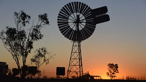
Paved roads are more welcome at the end of a long desert journey than they are at the beginning, and the thrill of having crossed a continent carried all the way into the town of Boulia. With its pubs and provisions, where glorious sunsets were a backdrop to creaking windmills, Boulia was a true outback town. Along its broad main street, locals stopped their vehicles in the middle of the road to chat.
The Boulia-Winton road hadn't left the desert behind, merely tamed a path through it. Desert country here consisted of spinifex and the flat-topped mesas of the Cawnpore Range. More big skies were to follow, and the Middleton Hotel felt like a film set, so closely did it resemble the stereotype of an isolated outback pub.
And then my final destination of Winton, as first one, then a line of buildings filled the horizon. It was a sign of the busier world that lay ahead. It took every ounce of willpower not to turn around and return back down the road.
The Open Road is a celebration of the world's most remarkable highways and byways, and a reminder that some of the greatest travel adventures happen via wheels.
--
Join more than three million BBC Travel fans by liking us on Facebook, or follow us on Twitter and Instagram.
If you liked this story, sign up for the weekly bbc.com features newsletter called "The Essential List". A handpicked selection of stories from BBC Future, Culture, Worklife and Travel, delivered to your inbox every Friday.
