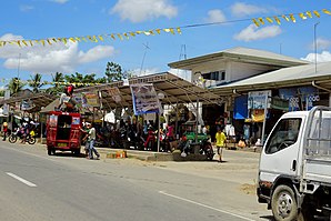
San Miguel, Bohol: Difference between revisions
Appearance
Content deleted Content added
Update from Wikipedia (en) |
No edit summary |
||
| (One intermediate revision by the same user not shown) | |||
| Gulis 1: | Gulis 1: | ||
{{Infobox lokasyon}} |
|||
[[Image:Ph_locator_bohol_san miguel.png|right|230px|Map of Bohol showing the location of San Miguel]] |
|||
| ⚫ | Ing '''San Miguel''' pang5 yang klasing [[Balen Filipinas|balen]] king [[Lalawigan Filipinas|lalawigan]] ning [[Bohol|Bohol]], [[Filipinas]]. Agpang keng {{wikidata|qualifier|single|P1082|P585}} ning sensus, atin yang populasyun a {{PH wikidata|population_total}} a katau kareng {{PH wikidata|household}} a pamimalemale. |
||
{{Philippine Census |
|||
| title = Sensus ning Populasyun <br> San Miguel, Bohol |
|||
| 1990 = 16775 |
|||
| 1995 = 17979 |
|||
| 2000 = 20828 |
|||
| 2007 = 22199 |
|||
| 2010 = 23574 |
|||
| 2015 = 24135 |
|||
| 2020 = |
|||
| 2025 = |
|||
| 2030 = |
|||
|}} |
|||
| ⚫ | |||
==Deng Barangay== |
==Deng Barangay== |
||
| ⚫ | |||
Ing San Miguel atin yang 18ng [[barangay]]. |
Ing San Miguel atin yang 18ng [[barangay]]. |
||
| Gulis 43: | Gulis 30: | ||
</td></tr></table> |
</td></tr></table> |
||
== Demograpiku == |
|||
<gallery> |
|||
{{Populasyon}} |
|||
San Miguel Bohol 1.jpg |
|||
== Panibatan == |
|||
| ⚫ | |||
{{reflist}} |
|||
</gallery> |
|||
==Kasusug Kilwal== |
|||
== Suglung Palwal == |
|||
| ⚫ | |||
*[ |
* [https:https://www.philatlas.com/ PhilAtlas.com] |
||
| ⚫ | |||
* [https://web.archive.org/web/20161010201809/https://www.blgs.gov.ph/lgpmsv2/cmshome/index.php?pageID=23 Local Governance Performance Management System] |
|||
{{Bohol}} |
{{Bohol}} |
||
Ing kasalungsungan a pamagbayu aniang 15:52, 25 Agostu 2020
San Miguel | |
|---|---|
 | |
 Mapa ning Bohol ampong San Miguel ilage | |
 | |
| Puuk: 10°0'N, 124°19'E | |
| Bansa | Filipinas |
| Labuad | Kalibudtang Visayas (Rehiyong VII) |
| Lalawigan | Bohol |
| Tuknangan | Balen |
| Mitatag | Marsu 14, 1961 |
| Barangay | 18 |
| Sukad | |
| • Kabilugan | 123.29 km2 (47.60 sq mi) |
| Elebasyun | 45 m (148 ft) |
| Populasyun (Sensu ning 1 Mayu 2020) | |
| • Kabilugan | 25,356 |
| • Densidad | 210/km2 (530/sq mi) |
| • Pamimalemale | 5,937 |
| Economia | |
| • Uryan | pangapat yang klasing balen |
| • Panakitan | ₱126,012,082.3455,514,868.4365,541,650.8675,623,855.2083,007,596.9998,058,274.71102,407,523.03103,345,189.97116,197,980.89139,263,940.55188,243,025.36 (2020) |
| • Activos | ₱309,453,789.9272,668,331.5564,551,710.7275,605,753.57155,365,700.33196,753,890.53225,154,455.94247,995,632.81278,681,087.09361,794,409.74450,916,302.17 (2020) |
| • Pasivos | ₱110,965,343.5344,437,232.6233,942,367.5838,713,801.68110,152,185.9912,364,074.5097,068,337.4182,670,406.61110,062,766.17140,169,547.41143,849,307.48 (2020) |
| • Gastos | ₱127,922,966.6354,286,397.7061,957,899.2563,731,590.0572,863,750.9480,745,064.4389,760,133.8494,724,684.81115,714,171.04131,679,732.56169,485,845.21 (2020) |
| Kodigo Postal | 6323 |
| PSGC | |
| IDD : area code | +63 (0)38 |
| Amanu | Boholano dialect amánung Sebuánu Tagálug |
Ing San Miguel pang5 yang klasing balen king lalawigan ning Bohol, Filipinas. Agpang keng 1 Mayu 2020 ning sensus, atin yang populasyun a 25,356 a katau kareng 5,937 a pamimalemale.
Deng Barangay
[mag-edit | alilan ya ing pikuwanan]
Ing San Miguel atin yang 18ng barangay.
|
|
Demograpiku
[mag-edit | alilan ya ing pikuwanan]| Taun | Pop. | ±% p.a. |
|---|---|---|
| 1970 | 10,051 | — |
| 1975 | 11,117 | +2.04% |
| 1980 | 12,220 | +1.91% |
| 1990 | 16,775 | +3.22% |
| 1995 | 17,979 | +1.31% |
| 2000 | 20,828 | +3.20% |
| 2007 | 22,199 | +0.88% |
| 2010 | 23,574 | +2.21% |
| 2015 | 24,135 | +0.45% |
| 2020 | 25,356 | +0.98% |
| Sanggunian: Philippine Statistics Authority[1][2][3][4] | ||
Panibatan
[mag-edit | alilan ya ing pikuwanan]- ↑ Census of Population (2015). "Total Population by Province, City, Municipality and Barangay". Total Population by Province, City, Municipality and Barangay. PSA.
- ↑ Census of Population and Housing (2010). "Total Population by Province, City, Municipality and Barangay". Total Population by Province, City, Municipality and Barangay. NSO.
- ↑ Censuses of Population (1903–2007). "Table 1. Population Enumerated in Various Censuses by Province/Highly Urbanized City: 1903 to 2007". Table 1. Population Enumerated in Various Censuses by Province/Highly Urbanized City: 1903 to 2007. NSO. https://archive.org/download/PhilippinesCensusofPopulationLGUs19032007/Region%207%20Central%20Visayas%20Philippines%20Census%20of%20Population%201903%20-%202007.xlsx.
- ↑ Province of Bohol. Municipality Population Data. Local Water Utilities Administration Research Division. Retrieved on [[Disiembri 17, 2016]].
Suglung Palwal
[mag-edit | alilan ya ing pikuwanan]| Tagbilaran (kapitolyo) | |
| Balen | Alburquerque ▪ Alicia ▪ Anda ▪ Antequera ▪ Baclayon ▪ Balilihan ▪ Batuan ▪ Bien Unido ▪ Bilar ▪ Buenavista ▪ Calape ▪ Candijay ▪ Carmen ▪ Catigbian ▪ Clarin ▪ Corella ▪ Cortes ▪ Dagohoy ▪ Dáno ▪ Dauis ▪ Dimiao ▪ Duero ▪ Garcia Hernandez ▪ Getafe ▪ Guindulman ▪ Inabanga ▪ Jagna ▪ Lila ▪ Loay ▪ Loboc ▪ Loon ▪ Mabini ▪ Maribojoc ▪ Panglao ▪ Pilar ▪ President Carlos P. Garcia ▪ Sagbayan ▪ San Isidro ▪ San Miguel ▪ Sevilla ▪ Sierra Bullones ▪ Sikatuna ▪ Talibon ▪ Trinidad ▪ Tubigon ▪ Ubay ▪ Valencia |
| Lakanbalen | Tagbilaran |
