HoloLens APP for ESRI-APP-Competition
This repository was created for the ECCE'19 Competition in which teams were tasked to create new and unique apps powered by Esri technology and open data to help address a problem related to a specific theme. As the theme of 2019 is about 'Sustainable Urban Development' and 'Sustainable Communities', we targeted to create an App that can run on Desktop or mobile devices that can support the Virtual Reality (VR) and Augmented Reality (AR) technologies.
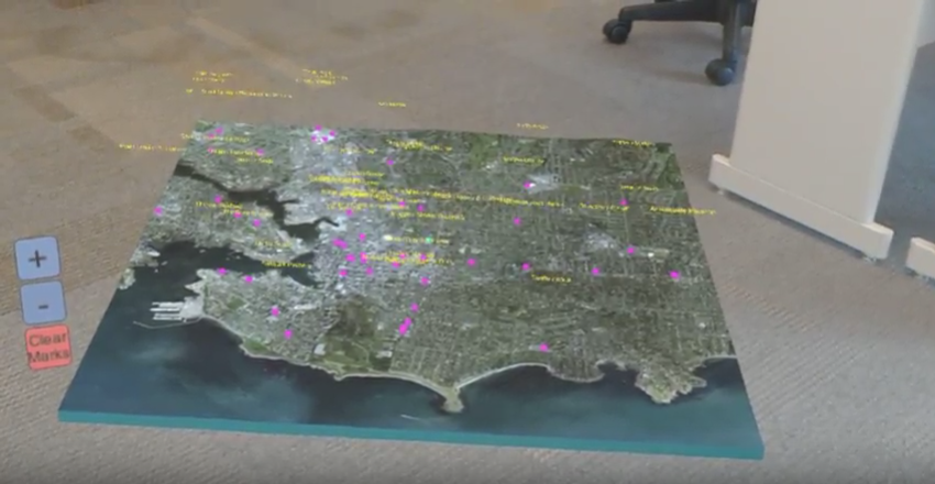
Urban designing is about shaping the physical features of cities, towns and villages and planning for the provision of municipal services to residents and visitors. Rather than proposing a traditional on-side field research before the real designing with manual drawing and measurement on papers, modern designing can be easily tasked on a digital map from which multiple kinds of geophysical information can be retrieved quickly and accurately. However, designers are usually used to do the planning on a 2-dimentional (2D) displayed basemap (e.g. Esri ArcGIS Maps) which has limitation for only showing a top-down view of the planned area, while a more immersive experience could be provided if the map can be displaned in 3D. Based on this idea, this application was created for computer-aided urban designing in a more interative way of using voice control and 3D immersive display.
This is an application designed for users who are embracing VR/AR world. To be more specific, an user can browse a 3D virtual Esri map with a Microsoft Hololens device (or using a HoloLens Emulator if no physical device availble).
A video demo can be checked from the link below:
https://drive.google.com/file/d/1T57VUWhBEHn68JYZzMUzrviTIxz798Az/view?usp=sharing
This github repo contains source code for an experimental HoloLens mapping application developed by Esri's Prototype Lab. The original post can be found here:
https://github.com/Esri/hololens-terrain-viewer
Built on top of the original application, this program has more new features enabled, such as voice recognition (using Microsoft .Net API) and voice control. As introduced in the video demo, a user can use voice control to change map locations (e.g. "show to 'Vancouver'") and do multiple find-place searches (e.g. "find 'sushi'", "find 'cherry blossom'").
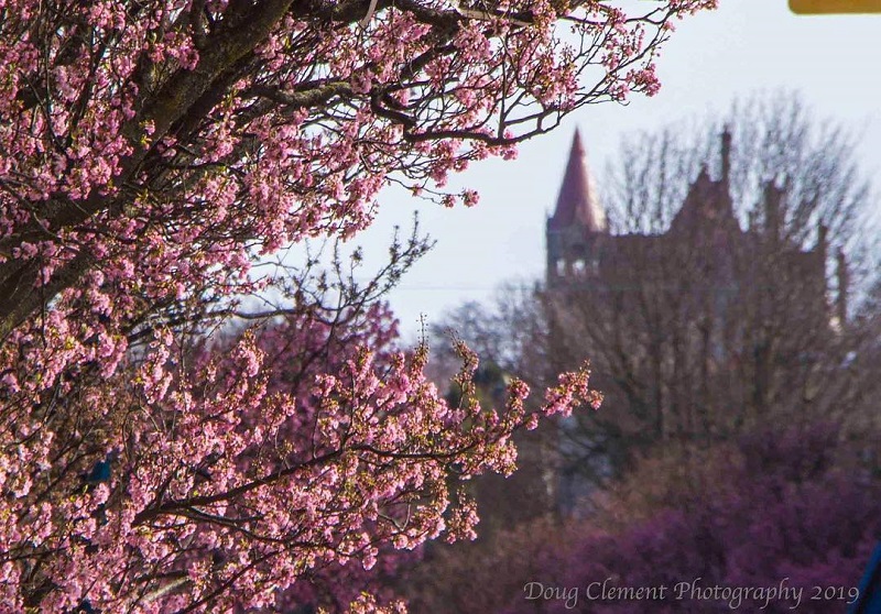
“This is why I live here!” exclaims many a Victoriarites during cherry blossom season. Each spring, as the rainy season fades, city dwellers pack their sweaters away and are rewarded with one of the world’s most cheerful sites: thousands of cherry trees bursting with pink and white blooms.
Victoria’s many parks and gardens are ideal showcases for the beloved trees, but there are also a number of urban places to view these pink and white beauties.
-
VIEW STREET One of the most well-known places to view spring blossoms is along View Street in the heart of Downtown Victoria. This street is usually the first to explode in a sea of pink flowers each February/March and the nearby architecture adds an undeniable je ne sais quoi (I do not know what) to any photo!
-
BLANSHARD STREET Find bunches of colourful cherry and plum blossoms all along Blanshard Street, from Fort Street all the way to the Parkside Hotel & Spa near St. Ann’s Academy National Historic Site.
-
BELLEVILLE STREET AT THE INNER HARBOUR The Inner Harbour is also home to blossoming trees and flowers this time of year. Find especially bright blooms outside the Hotel Grand Pacific and The Robert Bateman Centre on the south side of the Inner Harbour.
And many many more places where you can't imagine and it always has so much fun to discover it by yourself! With our application you can just easily ask "find 'cherry blossom'" and the locations of all the cherry blossom which is showing during the blossom period within Victoria will be showing in the 3D Ersi map! We use the open data for the "tree species" from the City of Victoria to query the blossoming Prunus trees. The open data can be accessed here:
https://opendata.victoria.ca/datasets/tree-species
- Check out or download the entire repository from github and install all the tools for the HoloLens environment. Make sure you have the latest update for Visual Studio 2017 and Unity and install the "Windows 10 SDK". More detailled instructions can be found here:
https://docs.microsoft.com/en-us/windows/mixed-reality/using-visual-studio
-
Once the environment was setup successfully (might take a few hours to install the tools), open 'ESRI-APP-Competition.sln' in Microsoft Visual Studio 2017. You can either choose to run the application from the real HoloLens device if you have one or choose to run on the Hololens Emulator.
-
Have fun and enjoy finding the cherry blossom!


