Since Strapi does not support native database formats I convert requests before they being sent to the querybuilder and convert all the geometry objects to the geojson.
Setup your strapi app as usual
npx create-strapi-app@latest my-project --quickstartInstall pg and strapi-plugin-postgis
npm install pg --save
npm i strapi-plugin-postgis
Make sure to config your strapi to use postgrs database as backend, Use this link in case you need any help with this step (https://strapi.io/blog/postgre-sql-and-strapi-setup)
Make sure to install postgis on your database server.
Modify your middlewares as following to let strapi load osm tiles. Add '*.tile.openstreetmap.org' to the img-src as follows
// ./config/middlewares.js
module.exports = [
  'strapi::errors',
  {
    name: 'strapi::security',
    config: {
      contentSecurityPolicy: {
        useDefaults: true,
        directives: {
          'img-src': ["'self'", 'data:', 'blob:', '*.tile.openstreetmap.org'],
          upgradeInsecureRequests: null,
        },
      },
    },
  },
  'strapi::cors',
  'strapi::poweredBy',
  'strapi::logger',
  'strapi::query',
  'strapi::body',
  'strapi::session',
  'strapi::favicon',
  'strapi::public',
];
Run strapi and you should see the following line
[2022-06-03 10:47:25.194] info: Welcome to Strapi Postgis 🚀 + 🐘 + 🗺️ | 3.1 USE_GEOS=1 USE_PROJ=1 USE_STATS=1
Now in your api folder modify content-types and add a new column with the following format
{
"kind": "collectionType",
.
.
.
"attributes": {
.
.
.
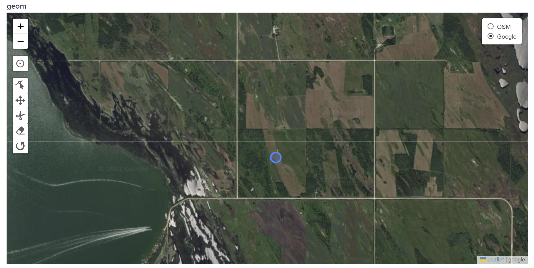
"geom": { //--> your column name. you can change to anything
"columnType": {
"type": "specificType",
"args": [
"geometry(POINT,4326)" //-> change this line according to the Supported Data Types section
]
},
"type": "json", //->don't change this
"fieldRenderer": "postgis" //->don't change this
}
}
}
"geom": {
      "columnType": {
        "type": "specificType",
        "args": [
          "geometry(POINT,4326)"
        ]
      },
      "type": "json",
      "fieldRenderer": "postgis"
    }
-
POINT Z (0 0 0)
-
POINT ZM (0 0 0 0)
-
POINT EMPTY
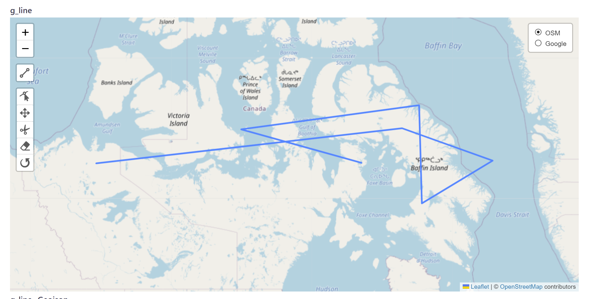
    "g_line": {
      "columnType": {
        "type": "specificType",
        "args": [
          "geometry(LINESTRING,4326)"
        ]
      },
      "type": "json",
      "fieldRenderer": "postgis"
    }
- LINESTRING EMPTY
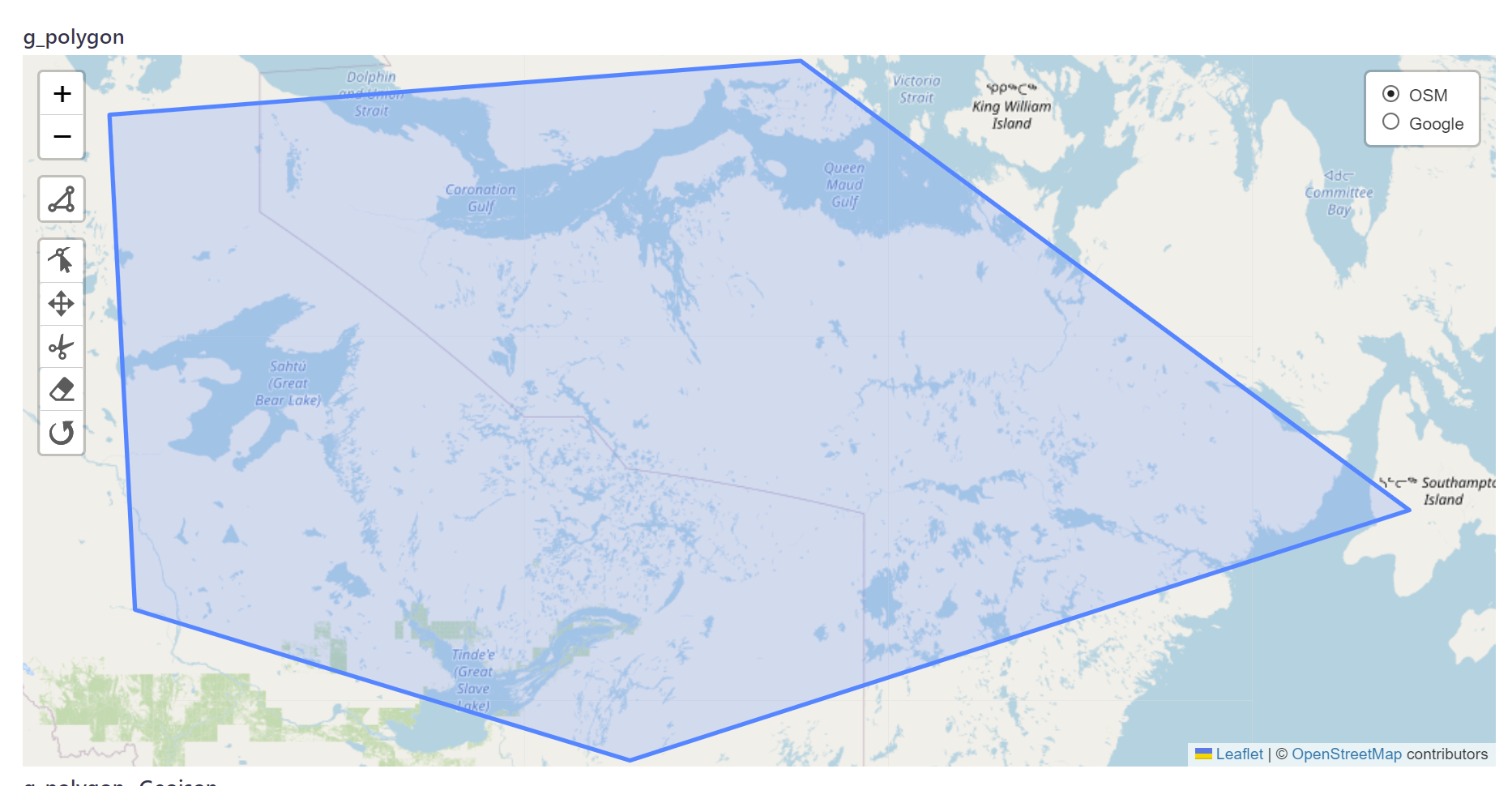
    "g_polygon": {
      "columnType": {
        "type": "specificType",
        "args": [
          "geometry(POLYGON,4326)"
        ]
      },
      "type": "json",
      "fieldRenderer": "postgis"
    }
-
MULTIPOINT((0 0),(1 2))
-
MULTIPOINT Z ((0 0 0),(1 2 3))
-
MULTIPOINT EMPTY
-
MULTILINESTRING((0 0,1 1,1 2),(2 3,3 2,5 4))
-
MULTIPOLYGON(((0 0,4 0,4 4,0 4,0 0),(1 1,2 1,2 2,1 2,1 1)), ((-1 -1,-1 -2,-2 -2,-2 -1,-1 -1)))
-
GEOMETRYCOLLECTION(POINT(2 3),LINESTRING(2 3,3 4))
-
GEOMETRYCOLLECTION EMPTY
- Add tests
- Support all the types
- Add query options like sort by distance, overlap and etc.
- Develop dashboard
- Add cool pg queries and tilings ;)
- strapi-plugin-point-list for the idea of how to add a custom components to the strapi content types
- postgis knex plugin
- leaflet editor plugin
- strapi team
- and so many other stuff